County of Gunbower
Cadastral in Victoria, Australia
| Gunbower Victoria | |||||||||||||||
|---|---|---|---|---|---|---|---|---|---|---|---|---|---|---|---|
 Location in Victoria | |||||||||||||||
| |||||||||||||||
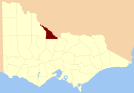
The County of Gunbower is one of the 37 counties of Victoria which are part of the cadastral divisions of Australia, used for land titles. It is located to the south of the Murray River, from Swan Hill to Echuca.
The County of Gunbower was proclaimed in 1871, with others from the Loddon Land District. The name is an aboriginal word.
Parishes
Parishes include:
- Cohuna, Victoria
- Gannawarra, Victoria
- Gunbower, Victoria
- Gunbower West, Victoria
- Kerang, Victoria
- Loddon, Victoria
- Macorna, Victoria
- Millewa, Victoria
- Mincha, Victoria
- Mincha West, Victoria
- Mologa, Victoria
- Murrabit, Victoria
- Murrabit West, Victoria
- Patho, Victoria
- Terrick Terrick East, Victoria
- Terrick Terrick West, Victoria
- Tragowel, Victoria
- Torrumbarry, Victoria
- Torrumbarry North, Victoria
- Wharparilla, Victoria
- Yarrowalla, Victoria
References
- Vicnames, place name details
- Research aids, Victoria 1910
- County of Gunbower, Cadastral map showing parish boundaries and land ownership, 1890. National Library of Australia
- v
- t
- e
- Anglesey
- Benambra
- Bendigo
- Bogong
- Borung
- Bourke
- Buln Buln
- Croajingolong
- Dalhousie
- Dargo
- Delatite
- Dundas
- Evelyn
- Follett
- Gladstone
- Grant
- Grenville
- Gunbower
- Hampden
- Heytesbury
- Kara Kara
- Karkarooc
- Lowan
- Millewa
- Moira
- Mornington
- Normanby
- Polwarth
- Ripon
- Rodney
- Talbot
- Tambo
- Tanjil
- Tatchera
- Villiers
- Weeah
- Wonnangatta
35°59′S 144°10′E / 35.983°S 144.167°E / -35.983; 144.167


