County of Grenville, Victoria
Cadastral in Victoria, Australia
| Grenville Victoria | |||||||||||||||
|---|---|---|---|---|---|---|---|---|---|---|---|---|---|---|---|
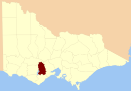 Location in Victoria | |||||||||||||||
| |||||||||||||||
The County of Grenville is one of the 37 counties of Victoria which are part of the cadastral divisions of Australia, used for land titles. It is located to the north-east of Lake Corangamite and includes Cressy. Ballarat is on its north-eastern edge. The boundary to the east is the Yarrowee River, and to the south part of the Barwon River. Colac is on its southern edge. The county was proclaimed in 1849.
Parishes
Parishes within the county:
- Argyle, Victoria
- Ballaarat, Victoria
- Bungaree, Victoria
- Cardigan, Victoria
- Carngham, Victoria
- Clarkesdale, Victoria
- Commeralghip, Victoria
- Corindhap, Victoria
- Cressy, Victoria
- Cundare, Victoria
- Dereel, Victoria
- Doroq, Victoria
- Dreeite, Victoria
- Enfield, Victoria
- Gellibrand, Victoria
- Haddon, Victoria
- Hesse, Victoria
- Karngun, Victoria
- Kurac-a-ruc, Victoria
- Lawaluk, Victoria
- Lynchfield, Victoria
- Mannibadar, Victoria
- Mindai, Victoria
- Mirnee, Victoria
- Mortchup, Victoria
- Murdeduke, Victoria
- Naringhil North, Victoria
- Naringhil South, Victoria
- Ondit, Victoria
- Poliah North, Victoria
- Poliah South, Victoria
- Poorneet, Victoria
- Scarsdale, Victoria
- Shelford, Victoria
- Shelford West, Victoria
- Smythesdale, Victoria
- Turkeeth, Victoria
- Wallinduc, Victoria
- Warracbarunah, Victoria
- Warrambine, Victoria
- Warrion, Victoria
- Weering, Victoria
- Wilgul North, Victoria
- Wilgul South, Victoria
- Windermere, Victoria
- Wingeel, Victoria
- Wurrook, Victoria
- Yarima, Victoria
- Yarrowee, Victoria
References
- Vicnames, place name details
- Research aids, Victoria 1910
37°40′S 143°40′E / 37.667°S 143.667°E / -37.667; 143.667
- v
- t
- e
- Anglesey
- Benambra
- Bendigo
- Bogong
- Borung
- Bourke
- Buln Buln
- Croajingolong
- Dalhousie
- Dargo
- Delatite
- Dundas
- Evelyn
- Follett
- Gladstone
- Grant
- Grenville
- Gunbower
- Hampden
- Heytesbury
- Kara Kara
- Karkarooc
- Lowan
- Millewa
- Moira
- Mornington
- Normanby
- Polwarth
- Ripon
- Rodney
- Talbot
- Tambo
- Tanjil
- Tatchera
- Villiers
- Weeah
- Wonnangatta
 | This article about a location in Victoria, Australia is a stub. You can help Wikipedia by expanding it. |
- v
- t
- e


