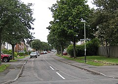
Hester’s Way
Hesters Way
 |
| Państwo |  Wielka Brytania Wielka Brytania
|
| Kraj |  Anglia Anglia
|
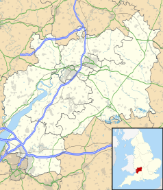
| Region | South West |
| Hrabstwo | Gloucestershire |
| Dystrykt | Cheltenham |
Populacja (2011)
• liczba ludności |
6902
|
Położenie na mapie Gloucestershire |
Położenie na mapie Wielkiej Brytanii |
Położenie na mapie Anglii |
| 51°54′30″N 2°07′00″W/51,908333 -2,116667 |
Hester’s Way[1] lub Hesters Way – dzielnica miasta Cheltenham, w Anglii, w Gloucestershire, w dystrykcie Cheltenham[2]. W 2011 roku dzielnica liczyła 6902 mieszkańców[3].
Przypisy
- ↑ Geograph
- ↑ Ordnance Survey linked data
- ↑ Neighbourhood Statistics. [dostęp 2015-12-18]. [zarchiwizowane z tego adresu (2015-12-23)].
Miejscowości dystryktu Cheltenham
- All Saints
- Battledown
- Benhall and the Reddings
- Charlton Kings
- Charlton Kings (dzielnica)
- Charlton Park
- Cheltenham
- College
- Hester’s Way (Hesters Way)
- Lansdown
- Leckhampton
- Leckhampton (dzielnica)
- Oakley
- Park
- Pittville
- Prestbury
- Prestbury (dzielnica)
- Springbank
- St. Mark’s
- St. Paul’s
- St. Peter’s
- Swindon
- Swindon Village
- Up Hatherley
- Up Hatherley (dzielnica)
- Warden Hill
|