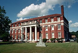
Lawrence County (Mississippi)

Lawrence County i Mississippi
Grunnlagt1814
Oppkalt etterJames Lawrence
FylkesseteMonticello
Areal
- Totalt
- Land
- Vann

1 128,54 km²
1 115,33 km²
13,21 km²
Befolkning
- Tetthet
13 457 (2006)
11,92 innb./km²
Kart
Lawrence County
31°33′N 90°07′V

Lawrence County på Commons

Lawrence County er et fylke i den amerikanske delstaten Mississippi. Administrasjonssenteret ligger i Monticello.[1]

Referanser

  1. ^ «How much do you know about your county?». County Explorer. Arkivert fra originalen 7. oktober 2015. Besøkt 10. februar 2016. 

Eksterne lenker

  • Offisielt nettsted Rediger på Wikidata
  • (en) Lawrence County, Mississippi – kategori av bilder, video eller lyd på Commons Rediger på Wikidata
  • v
  • d
  • r
Mississippis flagg
Adams · Alcorn · Amite · Attala · Benton · Bolivar · Calhoun · Carroll · Chickasaw · Choctaw · Claiborne · Clarke · Clay · Coahoma · Copiah · Covington · DeSoto · Forrest · Franklin · George · Greene · Grenada · Hancock · Harrison · Hinds · Holmes · Humphreys · Issaquena · Itawamba · Jackson · Jasper · Jefferson · Jefferson Davis · Jones · Kemper · Lafayette · Lamar · Lauderdale · Lawrence · Leake · Lee · Leflore · Lincoln · Lowndes · Madison · Marion · Marshall · Monroe · Montgomery · Neshoba · Newton · Noxubee · Oktibbeha · Panola · Pearl River · Perry · Pike · Pontotoc · Prentiss · Quitman · Rankin · Scott · Sharkey · Simpson · Smith · Stone · Sunflower · Tallahatchie · Tate · Tippah · Tishomingo · Tunica · Union · Walthall · Warren · Washington · Wayne · Webster · Wilkinson · Winston · Yalobusha · Yazoo
USAs flagg
Oppslagsverk/autoritetsdata
VIAF · LCCN · GeoNames · MusicBrainz · GNIS