Wilayah Alessandria
Wilayah Alessandria | |
|---|---|
Wilayah | |
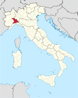 Map highlighting the location of the province of Alessandria in Italy | |
| Negara |  Itali Itali |
| Wilayah |  Piedmont Piedmont |
| Ibu kota | Alessandria |
| Komun | 190 |
| Pentadbiran | |
| • Presiden | Paolo Filippi |
| Keluasan | |
| • Jumlah | 3,560 km2 (1,370 batu persegi) |
| Penduduk (2005) | |
| • Jumlah | 429,080 |
| • Kepadatan | 120/km2 (310/batu persegi) |
| Zon waktu | UTC+1 (CET) |
| • Musim panas (DST) | UTC+2 (CEST) |
| Postal code | 15010-15013, 15015-15018, 15020-15036, 15038-15046, 15048-15053, 15055-15079, 15100 |
| Telephone prefix | 010, 019, 0131, 0141, 0142, 0143, 0144 |
| Pendaftaran kenderaan | AL |
| ISTAT | 06 |
Alessandria (bahasa Itali: Provincia di Alessandria) merupakan sebuah wilayah yang terletak di daerah Piemonte di Itali. Ibukotanya terletak di bandar Alessandria. Keluasannya adalah 3,560 km², dan penduduknya seramai 418,231 (2001). Terdapat 190 comune di wilayah ini (sumber: Istat, lihat pranala ini).
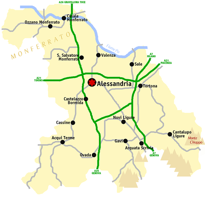
Peta
Pautan luar
 Kategori berkenaan Wilayah Alessandria di Wikimedia Commons
- Official website
- Official web site for European Sacred Mounts
- MonferratoArte (Itali) A historical and bibliographical directory of artists active in the extra-urban Churches of the Diocese of Casale Monferrato.
- Laws and Statutes of the Carpeneto commune, 15th century, Center for Digital Initiatives, University of Vermont Libraries


Koordinat: 44°54′48″N 8°37′12″E / 44.91333°N 8.62000°E / 44.91333; 8.62000


