Whichello, Queensland
Map all coordinates using OpenStreetMap
Download coordinates as:
- KML
- GPX (all coordinates)
- GPX (primary coordinates)
- GPX (secondary coordinates)
Suburb of Toowoomba Region, Queensland, Australia
27°17′39″S 151°59′53″E / 27.2941°S 151.9980°E / -27.2941; 151.9980 (Whichello (centre of locality))- 10.4 km (6 mi) SW of Crows Nest
- 29.1 km (18 mi) NNE of Highfields
- 44.1 km (27 mi) N of Toowoomba CBD
- 154 km (96 mi) WNW of Brisbane
| Suburbs around Whichello: | ||
| Plainby | Plainby | Crows Nest |
| Plainby | Whichello | Pechey |
| Groomsville | Groomsville | Pechey |
Whichello is a rural locality in the Toowoomba Region, Queensland, Australia.[2] In the 2021 census, Whichello had a population of 31 people.[1]
Geography
Whichello is on the Darling Downs in southern Queensland. It is bounded to the north-east by the Great Dividing Range.[3]
The terrain ranges from 560 to 75 metres (1,837 to 246 ft) above sea level. The land use is predominantly grazing on native vegetation with some crop growing.[4]
The Pechey-Maclagan Road runs through from east (Pechey) to south (Groomsville).[5]
History
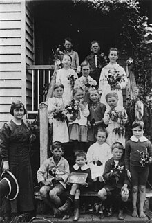
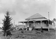
Whichello Provisional School opened on 18 April 1894. On 1 January 1909, it became Whichello State School. It closed on 22 January 1942.[6][7] It was on a 5-acre (2.0 ha) site on the northern side of Whichello School Road (27°17′32″S 152°00′39″E / 27.29223°S 152.01097°E / -27.29223; 152.01097 (Whichello State School (former))).[8][9] The site is now a park.[10]
Whichello Methodist Church opened in March 1907.[11] It was on a 1-acre (0.40 ha) on the northern side of Whichello School Road (27°17′35″S 152°00′51″E / 27.29296°S 152.01425°E / -27.29296; 152.01425 (Whichello Methodist Church (former))), appox 325 metres (1,066 ft) east of the school.[8][9] The timber church could seat 50 people. In 1952, the church building was relocated to Wilsonton.[12]
Demographics
In the 2016 census, Whichello had a population of 31 people.[13]
In the 2021 census, Whichello had a population of 31 people.[1]
Education
There are no schools in Whichello. The nearest government primary schools are Crows Nest State School in neighbouring Crows Nest to the north-east and Goombungee State School in Goombungee to the south-west. The nearest government secondary schools are Crows Nest State School (to Year 10) and Highfields State Secondary College (to Year 12) in Highfields to the south.[14]
References
Wikimedia Commons has media related to Whichello, Queensland.
- ^ a b c Australian Bureau of Statistics (28 June 2022). "Whichello (SAL)". 2021 Census QuickStats. Retrieved 28 February 2023.

- ^ "Whichello – locality in Toowoomba Region (entry 48094)". Queensland Place Names. Queensland Government. Retrieved 17 November 2019.
- ^ "Layers: Locality; Mountains and ranges; Contours; Watercourses". Queensland Globe. Queensland Government. Archived from the original on 19 December 2017. Retrieved 13 March 2024.
- ^ "Layers: Locality; Protected areas and forests; Land use". Queensland Globe. Queensland Government. Archived from the original on 19 December 2017. Retrieved 13 March 2024.
- ^ Whichello, Queensland (Map). OpenStreetMap. Archived from the original on 28 March 2022. Retrieved 28 March 2022.
- ^ Queensland Family History Society (2010), Queensland schools past and present (Version 1.01 ed.), Queensland Family History Society, ISBN 978-1-921171-26-0
- ^ "Agency ID 9273, Whichello State School". Queensland State Archives. Retrieved 24 September 2023.
- ^ a b "Crows Nest" (Map). Queensland Government. 1945. Archived from the original on 23 September 2023. Retrieved 24 September 2023.
- ^ a b "Parish of Douglas" (Map). Queensland Government. 1951. Archived from the original on 23 September 2023. Retrieved 24 September 2023.
- ^ "Queensland Globe". State of Queensland. Retrieved 24 September 2023.
- ^ "DOWNS NEWS". Darling Downs Gazette. Vol. XLIX, no. 7, 969. Queensland, Australia. 23 March 1907. p. 7. Archived from the original on 13 March 2024. Retrieved 24 September 2023 – via National Library of Australia.
- ^ "Whichello Methodist Church | Whichello". Queensland Religious Places Database. Archived from the original on 13 March 2024. Retrieved 13 March 2024.
- ^ Australian Bureau of Statistics (27 June 2017). "Whichello (SSC)". 2016 Census QuickStats. Retrieved 20 October 2018.
- ^ "Layers: Locality; Schools and school catchments". Queensland Globe. Queensland Government. Archived from the original on 19 December 2017. Retrieved 13 March 2024.
- v
- t
- e
- Acland
- Aubigny
- Biddeston
- Bowenville
- Brookstead
- Cabarlah
- Cambooya
- Cecil Plains
- Clifton
- Cooyar
- Crows Nest
- East Greenmount
- Evergreen
- Goombungee
- Gowrie
- Greenmount
- Haden
- Hampton
- Jondaryan
- Kingsthorpe
- Kooroongarra
- Kulpi
- Maclagan
- Millmerran
- Mount Tyson
- Nangwee
- Nobby
- Oakey
- Pechey
- Peranga
- Pilton
- Pittsworth
- Quinalow
- Southbrook
- Turallin
- Wyreema
- Yarraman
- Anduramba
- Ascot
- Athol
- Back Plains
- Balgowan
- Bergen
- Boodua
- Bongeen
- Branchview
- Bringalily
- Broxburn
- Brymaroo
- Budgee
- Bulli Creek
- Canning Creek
- Captains Mountain
- Cattle Creek
- Cawdor
- Cherry Creek
- Clontarf
- Coalbank
- Condamine Farms
- Condamine Plains
- Cressbrook Creek
- Cutella
- Cypress Gardens
- Devon Park
- Djuan
- Doctor Creek
- Domville
- Douglas
- Dunmore
- East Cooyar
- Ellangowan
- Elphinstone
- Emu Creek
- Evanslea
- Felton
- Felton South
- Forest Ridge
- Formartin
- Geham
- Gilla
- Glenaven
- Glencoe
- Googa Creek
- Gowrie Little Plain
- Gowrie Mountain
- Grapetree
- Grassdale
- Grays Gate
- Greenwood
- Groomsville
- Halliford
- Headington Hill
- Highgrove
- Highland Plains
- Hirstglen
- Irongate
- Irvingdale
- Jones Gully
- Kelvinhaugh
- Kilbirnie
- Kincora
- Kings Creek
- Kings Siding
- Kleinton
- Kooralgin
- Kurrowah
- Lavelle
- Lemontree
- Leyburn
- Lilyvale
- Linthorpe
- Malling
- Malu
- Manapouri
- Meringandan
- Meringandan West
- Merritts Creek
- Millmerran Downs
- Millmerran Woods
- Millwood
- Missen Flat
- Motley
- Mount Binga
- Mount Darry
- Mount Emlyn
- Mount Irving
- Mount Luke
- Mount Molar
- Mount Moriah
- Mountain Camp
- Muldu
- Muniganeen
- Narko
- Nevilton
- Norwin
- North Branch
- North Maclagan
- Nutgrove
- Palmtree
- Pampas
- Purrawunda
- Perseverance
- Pierces Creek
- Pinelands
- Plainby
- Punchs Creek
- Ramsay
- Rangemore
- Ravensbourne
- Rocky Creek
- Rosalie Plains
- Rossvale
- Ryeford
- Sabine
- Sandy Camp
- Scrubby Mountain
- Silverleigh
- Spring Creek
- Springside
- St Aubyn
- St Helens
- St Ruth
- Stonehenge
- Stoneleigh
- The Bluff
- The Pines
- Thornville
- Tipton
- Tummaville
- Umbiram
- Upper Cooyar Creek
- Upper Pilton
- Upper Pinelands
- Upper Yarraman
- Victoria Hill
- Wainui
- Wattle Ridge
- West Haldon
- West Prairie
- Western Creek
- Whichello
- Woodleigh
- Woolmer
- Woondul
- Wutul
- Yalangur
- Yandilla
- Yargullen
- Yarranlea
Main Article: Local government areas of Queensland


