Stötten
Municipality in Bavaria, Germany

Coat of arms
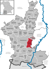
Location of Stötten within Ostallgäu district
(2023–29) Michael Neumann[1]
(2022-12-31)[2]
87675
Stötten (Swabian: Steeda) is a municipality in the district of Ostallgäu in Bavaria in Germany.
Climate
| Climate data for Stötten (1991–2020 normals) | |||||||||||||
|---|---|---|---|---|---|---|---|---|---|---|---|---|---|
| Month | Jan | Feb | Mar | Apr | May | Jun | Jul | Aug | Sep | Oct | Nov | Dec | Year |
| Mean daily maximum °C (°F) | 1.7 (35.1) | 2.8 (37.0) | 7.2 (45.0) | 12.2 (54.0) | 16.2 (61.2) | 19.7 (67.5) | 21.7 (71.1) | 21.7 (71.1) | 16.8 (62.2) | 11.7 (53.1) | 5.8 (42.4) | 2.6 (36.7) | 11.7 (53.1) |
| Daily mean °C (°F) | −0.7 (30.7) | −0.1 (31.8) | 3.5 (38.3) | 7.8 (46.0) | 11.8 (53.2) | 15.2 (59.4) | 17.1 (62.8) | 17.0 (62.6) | 12.7 (54.9) | 8.3 (46.9) | 3.2 (37.8) | 0.2 (32.4) | 8.0 (46.4) |
| Mean daily minimum °C (°F) | −3.1 (26.4) | −2.7 (27.1) | 0.3 (32.5) | 3.8 (38.8) | 7.7 (45.9) | 11.1 (52.0) | 13.0 (55.4) | 13.2 (55.8) | 9.4 (48.9) | 5.5 (41.9) | 0.9 (33.6) | −2.2 (28.0) | 4.8 (40.6) |
| Average precipitation mm (inches) | 75.7 (2.98) | 61.4 (2.42) | 79.0 (3.11) | 62.6 (2.46) | 108.8 (4.28) | 100.4 (3.95) | 127.1 (5.00) | 97.8 (3.85) | 82.0 (3.23) | 85.3 (3.36) | 83.3 (3.28) | 85.5 (3.37) | 1,056.5 (41.59) |
| Average precipitation days (≥ 1.0 mm) | 18.8 | 16.7 | 15.5 | 13.2 | 13.1 | 14.5 | 15.4 | 15.7 | 13.9 | 16.4 | 18.0 | 19.3 | 191.3 |
| Average snowy days (≥ 1.0 cm) | 18.5 | 17.7 | 10.9 | 2.1 | 0.1 | 0 | 0 | 0 | 0 | 0.4 | 6.1 | 14.3 | 70.1 |
| Average relative humidity (%) | 88.0 | 83.9 | 78.1 | 71.2 | 74.3 | 74.8 | 73.4 | 73.4 | 80.9 | 86.9 | 90.5 | 89.6 | 80.4 |
| Mean monthly sunshine hours | 63.6 | 84.8 | 132.6 | 181.3 | 207.1 | 224.1 | 241.3 | 227.2 | 163.0 | 107.2 | 59.6 | 52.9 | 1,744.7 |
| Source: World Meteorological Organization[3] | |||||||||||||
References
- ^ Liste der ersten Bürgermeister/Oberbürgermeister in kreisangehörigen Gemeinden, Bayerisches Landesamt für Statistik. Retrieved 5 September 2023.
- ^ Genesis Online-Datenbank des Bayerischen Landesamtes für Statistik Tabelle 12411-003r Fortschreibung des Bevölkerungsstandes: Gemeinden, Stichtag (Einwohnerzahlen auf Grundlage des Zensus 2011) (Hilfe dazu).
- ^ "World Meteorological Organization Climate Normals for 1991–2020". World Meteorological Organization Climatological Standard Normals (1991–2020). National Oceanic and Atmospheric Administration. Archived from the original on 12 October 2023. Retrieved 13 October 2023.
- v
- t
- e
Towns and municipalities in Ostallgäu
- Aitrang
- Baisweil
- Bidingen
- Biessenhofen
- Buchloe
- Eggenthal
- Eisenberg
- Friesenried
- Füssen
- Germaringen
- Görisried
- Günzach
- Halblech
- Hopferau
- Irsee
- Jengen
- Kaltental
- Kraftisried
- Lamerdingen
- Lechbruck
- Lengenwang
- Marktoberdorf
- Mauerstetten
- Nesselwang
- Obergünzburg
- Oberostendorf
- Osterzell
- Pforzen
- Pfronten
- Rettenbach am Auerberg
- Rieden
- Rieden am Forggensee
- Ronsberg
- Roßhaupten
- Rückholz
- Ruderatshofen
- Schwangau
- Seeg
- Stötten
- Stöttwang
- Unterthingau
- Untrasried
- Waal
- Wald
- Westendorf

Authority control databases | |
|---|---|
| International |
|
| National |
|
 | This Ostallgäu location article is a stub. You can help Wikipedia by expanding it. |
- v
- t
- e


