Sod, West Virginia
Unincorporated community in West Virginia, United States
38°14′39″N 81°52′34″W / 38.24417°N 81.87611°W / 38.24417; -81.8761125564
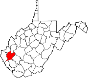
Sod (also Scioto) is an unincorporated community in northeastern Lincoln County, West Virginia, United States. It lies along West Virginia Route 214 east of the town of Hamlin, the county seat of Lincoln County.[1] Sod's elevation is 781 feet (238 m).[2] It has a post office with the ZIP code 25564.[3]
Sod is a part of the Huntington-Ashland, WV-KY-OH, Metropolitan Statistical Area (MSA). As of the 2010 census, the MSA had a population of 287,702. New definitions from February 28, 2013 placed the population at 363,000.[4]
References
- ^ Rand McNally. The Road Atlas '08. Chicago: Rand McNally, 2008, p. 112.
- ^ U.S. Geological Survey Geographic Names Information System: Sod, West Virginia, Geographic Names Information System, 1980-06-27. Accessed 2008-03-29.
- ^ USPS – Cities by ZIP Code
- ^ "Population statistics" (PDF). Archived from the original (PDF) on March 19, 2013.
- v
- t
- e
Municipalities and communities of Lincoln County, West Virginia, United States
County seat: Hamlin
communities
- Alkol
- Allen
- Atenville
- Bernie
- Bradyville
- Branchland
- Bulger
- Cuzzie
- Dollie
- East
- Eden Park
- Ferrellsburg
- Fourteen
- Fry
- Garretts Bend
- Gill
- Griffithsville
- Hager
- Hubball
- Irene
- Jenks
- Kinder
- Lattin
- Leet
- Midkiff
- Minerva
- Mud
- Myra
- Palermo
- Pleasant View
- Portersville
- Priestley
- Ranger
- Redwing
- Sheridan
- Sias
- Snowden
- Sod
- Spurlockville
- Sumerco
- Sweetland
- Toney
- Wewanta
- Woodville
- Yawkey
‡This populated place also has portions in an adjacent county or counties
- West Virginia portal
- United States portal
 | This article about a location in Lincoln County, West Virginia is a stub. You can help Wikipedia by expanding it. |
- v
- t
- e


