San Mateo, Florida
Place in Putnam County
San Mateo, Florida | |
|---|---|
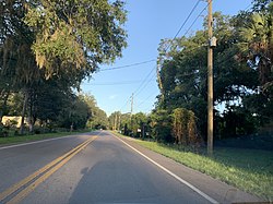 San Mateo as seen from Highway 100. | |
| County | Putnam County |
| Time zone | UTC-5 (EST) |
| • Summer (DST) | UTC-4 (EDT) |
| ZIP code | 32187[1] |
| Area code | 386 |
San Mateo is an unincorporated community in Putnam County, Florida, United States, located just southeast of the city of Palatka. It is on the east shore of the St. Johns River between buoys 12 and 15; stretching from Buzzard Island to the entrance to Dunn's Creek. The main road through San Mateo is US Route 17, with a southern terminus of the overlap with Florida State Roads 20 and 100.
Geography
San Mateo is located at 29°36′25″N 81°35′06″W / 29.607°N 81.585°W / 29.607; -81.585, with an elevation of 72 feet (22 m).[2]
References
- v
- t
- e
Municipalities and communities of Putnam County, Florida, United States
County seat: Palatka
- Crescent City
- Palatka

communities
‡This populated place also has portions in an adjacent county or counties
- Florida portal
- United States portal
29°36′00″N 81°35′00″W / 29.60000°N 81.58333°W / 29.60000; -81.58333
Authority control databases | |
|---|---|
| International |
|
| National |
|
This article about a location in Putnam County, Florida is a stub. You can help Wikipedia by expanding it. |
- v
- t
- e


