Sadwal Kalan
Place in Punjab, Pakistan
Sadwal Kalan سدوال کلاں | |
|---|---|
 Countryside around Sadwal Kalan | |
| Coordinates: 32°50′30.69″N 74°06′29.81″E / 32.8418583°N 74.1082806°E / 32.8418583; 74.1082806 | |
| Country |  Pakistan Pakistan |
| Province | Punjab |
| Region/Division | Gujrat |
| District | Gujrat |
| Tehsil | Kharian |
| Government | |
| Time zone | UTC+5 (PST) |
| Postal Code | 50991 |
| Area code | 053 |
Sadwal Kalan is a village in Gujrat District of Pakistan's Punjab province. Sadwal Kalan is a quite large village, which is situated about 3 kilometers away from Kotla to the east. The village is 38 kilometers from Gujrat District and about 30 kilometers from its Tehsil Kharian. The Union Council and administrative seat of Sadwal Kalan is Kakrali, which is 4 kilometers to the north. The border of Azad Kashmir also lies about 10 kilometers to the north. Most residents of the village belong to the Jatt tribe.
Gallery
-
 Crops of Bajra
 -
 Nice View of Flowers of Mustard(Sarsoon)
 -
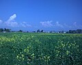 Flowers of Mustard in Kaalian
 -
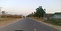 Sadwal Road New
 -
 A view of Mustard Flower Near Daali
 -
 Street Towards Pindi
 -
 Street Towards Pindi Awan


Neighbour villages
- Kakrali
- Kotla Arab Ali Khan
- Langrial
Ropari Sahan kalan Sohntra Aach Goch Pindi khokra Chakh sikander
References
- v
- t
- e


