Séguéla
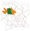
Place in Woroba, Ivory Coast
7°58′N 6°40′W / 7.967°N 6.667°W / 7.967; -6.667 Ivory Coast
 (2021 census)[2]
Séguéla is a town in western Ivory Coast. It is the seat of both the Woroba District and the Worodougou Region. It is also a commune and the seat of and a sub-prefecture of Séguéla Department.
Séguéla is served by Séguéla Airport. In 2021, the population of the sub-prefecture of Séguéla was 103,905.[2]
Villages
The forty two villages of the sub-prefecture of Séguéla and their population in 2014 are:[3]
- Bemasso (143)
- Fizanigoro (195)
- Gbena (1 307)
- Séguéla (46 189)
- Banandjé (363)
- Békro (174)
- Dangbasso (371)
- Diarabala (212)
- Djamina (359)
- Flana (166)
- Gbalo (649)
- Gbéna (212)
- Gbingoro (648)
- Gbofraka (348)
- Gbohovo (371)
- Gbolo (532)
- Gbona (589)
- Gnahoulégo (244)
- Kamana (284)
- Kavéna (333)
- Kénégbè-Sud (589)
- Kromina (196)
- Linguékro (477)
- Mamourla (282)
- Manguilo (138)
- Ména (250)
- Messoromasso (176)
- Mouina (767)
- Niangoro (232)
- Ouahama (1 050)
- Ouahi (685)
- Ouéla Katogola Ou Djiguibasso (349)
- Sakouasso (177)
- Séna (410)
- Siakasso 1 (724)
- Soba (635)
- Sokoura (163)
- Somina (427)
- Sotiéma (118)
- Sualla (499)
- Téguéla (1 579)
- Trafesso (162)
- v
- t
- e
Departments and sub-prefectures of Worodougou Region, Woroba DistrictRegional seat: Séguéla
* also a commune
References
Authority control databases | |
|---|---|
| International |
|
| National |
|
 | This Woroba District location article is a stub. You can help Wikipedia by expanding it. |
- v
- t
- e


