Rubottom, Oklahoma
Unincorporated community in Oklahoma, United States
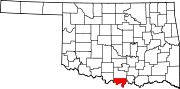
33°56′25″N 97°27′25″W / 33.94028°N 97.45694°W / 33.94028; -97.45694Rubottom is an unincorporated community in Love County, Oklahoma, United States.[1]
A post office was established at Rubottom, Indian Territory on Aug. 14, 1902. It was named for William P. Rubottom, a prominent landowner and cotton gin operator.[2] At the time of its founding, Rubottom was located in Pickens County, Chickasaw Nation.[3]
The community is part of the Turner Independent School District.
References
- v
- t
- e
Municipalities and communities of Love County, Oklahoma, United States
County seat: Marietta
- Marietta
- Leon
- Thackerville
communities
‡This populated place also has portions in an adjacent county or counties
- Oklahoma portal
- United States portal
 | This Oklahoma state location article is a stub. You can help Wikipedia by expanding it. |
- v
- t
- e


