Opatovac, Vukovar-Syrmia County
Village in Vukovar-Syrmia, Croatia
Opatovac | |
|---|---|
Village (Selo) | |
   | |
 | |
| Country |  Croatia Croatia |
| County |  Vukovar-Syrmia Vukovar-Syrmia |
| Municipality | Lovas |
| Area | |
| • Total | 7.1 sq mi (18.5 km2) |
| Population (2021)[2] | |
| • Total | 252 |
| • Density | 35/sq mi (14/km2) |
| Time zone | UTC+1 (CET) |
| • Summer (DST) | UTC+2 (CEST) |
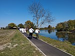
Opatovac (pronounced [opǎːtovat͡s], Serbian Cyrillic: Опатовац, Hungarian: Apáti, German: Sankt Lorenz) is a village in Croatia. It is connected by the D2 road. The village is home to one of the last remaining steppe grasslands in Croatia at the section of the Vukovar Plateau.[3]
History
The Serbian Orthodox Church of St. George was built in 1802 with the iconostasis dating back to 1769.[4]
During the so-called European migrant crisis the village hosted the temporary refugee camp where thousands of individuals received primary medical support and registration.[5]
See also
References
- ^ Register of spatial units of the State Geodetic Administration of the Republic of Croatia. Wikidata Q119585703.
- ^ "Population by Age and Sex, by Settlements, 2021 Census". Census of Population, Households and Dwellings in 2021. Zagreb: Croatian Bureau of Statistics. 2022.
- ^ n.a. (n.d.). "Stepska staništa kod Opatovca". Natura 2000. Retrieved 8 June 2023.
- ^ "Crkve u Veri, Kneževu, Marincima i Opatovcu". Srbi.hr, Joint Council of Municipalities. 23 March 2018. Retrieved 9 June 2023.
- ^ N1 info (7 June 2015). "EKSKLUZIVNE SNIMKE kampa u Opatovcu snimljene dronom" (in Croatian). N1 (TV channel). Retrieved 9 June 2023.
{{cite web}}: CS1 maint: numeric names: authors list (link)
- v
- t
- e
Villages of Vukovar-Syrmia County
(other villages in municipality)
45°15′40″N 19°10′12″E / 45.26111°N 19.17000°E / 45.26111; 19.17000
 | This Vukovar-Syrmia County geography article is a stub. You can help Wikipedia by expanding it. |
- v
- t
- e


