Norwood, Nelson County, Virginia
Unincorporated community in Virginia, US

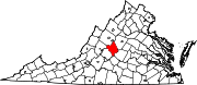
Norwood is an unincorporated community in Nelson County, Virginia, United States.[1] It was among the communities severely affected by flash flooding from Hurricane Camille in 1969.[2]
Montezuma was listed on the National Register of Historic Places in 1980.[3]
References
- ^ "Norwood". Geographic Names Information System. United States Geological Survey, United States Department of the Interior.
- ^ Garnett P. Williams and Harold P. Guy. Erosional and Depositional Aspects of Hurricane Camille in Virginia, 1969. United States Government Printing Office, 1973, pp. 1.
- ^ "National Register Information System". National Register of Historic Places. National Park Service. July 9, 2010.
- v
- t
- e
Municipalities and communities of Nelson County, Virginia, United States
County seat: Lovingston
- Afton‡
- Arrington
- Lovingston
- Nellysford
- Schuyler
- Shipman
- Wintergreen‡
communities
- Adial
- Allens Creek
- Avon
- Beech Grove
- Bryant
- Buffalo Springs
- Caskie
- Colleen
- Durrett Town
- Elma
- Faber
- Five Forks
- Four Forks
- Freshwater
- Gladstone
- Gordon Crossing
- Greenfield
- Greenway
- Gullysville
- Hendersons Store
- Jonesboro
- Kingswood
- Lakeview Heights
- Lanes Ford
- Lawthorne Mill
- Lodebar
- Lowesville
- Martins Store
- Massies Mill
- Midway Mills
- Montebello
- Nash
- Norwood
- Oak Ridge
- Old Myndus
- Onan
- Ottoway
- Piedmont
- Piney River
- Poplar Flats
- Ramsey
- Red Apple Orchard
- Rockfish
- Roseland
- Roses Mill
- Shady Lane
- Twin Poplars
- Tye River
- Tyro
- Warminster
- White Rock
- Wingina
- Woods Mill
‡This populated place also has portions in an adjacent county or counties
- Virginia portal
- United States portal
37°38′36″N 78°48′32″W / 37.64333°N 78.80889°W / 37.64333; -78.80889
 | This Nelson County, Virginia state location article is a stub. You can help Wikipedia by expanding it. |
- v
- t
- e


