Mount Webster
44°11.69′N 71°23.29′W / 44.19483°N 71.38817°W / 44.19483; -71.38817Geography Location Bean's Purchase, Coös County / Hart's Location, Carroll County, New Hampshire, U.S. Parent range Presidential Range Topo map USGS Crawford Notch Belknap Mountains Ossipee Mountains Wapack Range White Mountains Others
Mount Webster is a mountain located on the border between Coos County and Carroll County, New Hampshire. The mountain, formerly called Notch Mountain, is named after Daniel Webster (1782–1852), and is the south-westernmost of the Presidential Range of the White Mountains. Mount Webster is flanked to the northeast by Mount Jackson; to the southwest it faces Mount Willey across Crawford Notch.
The west face of Mount Webster drains directly into the Saco River, thence into the Gulf of Maine at Saco, Maine. The north and southeast faces drain into the Saco via Silver Cascade and Webster Brook respectively.
Mount Webster is on the western boundary of the Presidential Range - Dry River Wilderness. The Appalachian Trail, a 2,170-mile (3,500-km) National Scenic Trail from Georgia to Maine, runs along the ridge of the Presidentials, across the summit of Webster.
Gallery
-
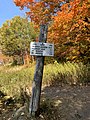 A sign at the start of the Webster-Jackson trail

See also
 New Hampshire portal

External links
- U.S. Geological Survey Geographic Names Information System: Mount Webster
- Mount Webster on Topozone
- PeakBagger.com: Mount Webster
- summitpost.org: Mount Webster
- v
- t
- e
- Bayle Mountain
- Larcom Mountain
- Mount Roberts
- Mount Shaw
- Mount Whittier
- Nickerson Mountain
- Turtleback Mountain
- Blue Job Mountain
- Crotched Mountain
- Gap Mountain
- Little Monadnock Mountain
- Lovewell Mountain
- Moose Mountain
- Mount Assurance
- Mount Cardigan
- Mount Kearsarge
- Mount Kelsey
- Mount Magalloway
- Mount Monadnock
- Mount Sunapee
- Pitcher Mountain
- Potanipo Hill
- Ragged Mountain
- Skatutakee Mountain
- Smarts Mountain
- Tenney Mountain
- Thumb Mountain
- Uncanoonuc Mountains
 | This New Hampshire state location article is a stub. You can help Wikipedia by expanding it. |
- v
- t
- e


