Magama, Nigeria
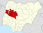
LGA in Niger State, Nigeria
10°28′N 5°03′E / 10.467°N 5.050°E / 10.467; 5.050 Nigeria
 (2006 census)
923

Magama is a Local Government Area in Niger State, Nigeria. Its headquarters are in the town of Nasko in the west of the area.
It has an area of 4,107 km2 and a population of 181,653 at the 2006 census.
The postal code of the area is 923.[1]
Climate
The weather in Magama is savanna tropical. With both a wet and dry season, it is warm every month. There is roughly 507 mm of rain every year in Magama, and the average annual temperature is 35 degrees. Averaging 55% humidity and a UV-index of 7, it is dry for 186 days out of every year.[2][3][4]
References
- ^ "Post Offices- with map of LGA". NIPOST. Archived from the original on 2012-11-26. Retrieved 2009-10-20.
- ^ "Magama weather and climate ☀️ Best time to visit 🌡️ Temperature". www.besttimetovisit.co.nz. Retrieved 2023-09-27.
- ^ "Magama weather forecast for today". justweather.org. Retrieved 2023-09-27.
- ^ "Magama, Niger, Nigeria Weather Forecast and Conditions - The Weather Channel | Weather.com". The Weather Channel. Retrieved 2023-09-27.
- v
- t
- e
Niger StateState capital: Minna
 | This Niger State, Nigeria location article is a stub. You can help Wikipedia by expanding it. |
- v
- t
- e


