List of NSW TrainLink railway stations

NSW TrainLink Intercity Map

NSW TrainLink Interstate map (highlighted in blue)
NSW TrainLink is a train operator of passenger services outside the metropolitan area of Sydney in New South Wales. The network is divided into two tiers; intercity – a commuter-based rail network centred on the Greater Sydney area, and regional – long distance and interstate services. The network is served by a fleet of double-deck electric multiple units and single-deck diesel trains.
List of current stations
| Station | Code | Image | Served by | Distance from Central station (km) | Date opened | Previous name(s) |
|---|---|---|---|---|---|---|
| Aberdeen | ABD |  | North Western Region Hunter Line (Scone Branch) | 300.730 | 20 October 1870 | |
| Adamstown | ADT |  | Central Coast & Newcastle Line | 161.120 | 15 August 1887 | |
| Albion Park |  | South Coast Line | 103.340 | 9 November 1887 | Oak Flats (1887–1888) | |
| Albury | ABX ALY (Vic) |  | Southern Region 1 non-NSW TrainLink service
| 642.40 | 3 February 1881 | |
| Armidale | ARM |  | North Western Region | 578 | 3 February 1883 | |
| Austinmer | AUR |  | South Coast Line | 68.590 | 1 September 1887 | |
| Awaba | AWB |  | Central Coast & Newcastle Line | 137.310 | 15 August 1887 | |
| Bargo | BZG |  | Southern Highlands Line | 102.870 | 13 July 1919 | West Bargo (1919–1921) |
| Bathurst | BHS |  | Western Region Blue Mountains Line | 239.900 | 4 April 1876 | |
| Bell | BEL |  | Blue Mountains Line | 137.120 | 1 May 1875 | Mount Wilson (1875–1889) |
| Bellambi | BLM |  | South Coast Line | 75.550 | 1889 | |
| Bellata | BZT | North Western Region | 615 | 1897 | Woolbra (1897–1909) | |
| Benalla | BEN |  | Southern Region 1 non-NSW TrainLink service
| 742.6 | 18 August 1873 | |
| Beresfield |  | Hunter Line | 179.810 | 31 July 1925 | ||
| Berry |  | South Coast Line | 140.840 | 2 June 1893 | ||
| Blackheath | BKE |  | Blue Mountains Line | 120.670 | 1 August 1862 | |
| Blaxland | BXD |  | Blue Mountains Line | 71.480 | 11 July 1867 | Wascoes (1867–1879) |
| Blayney | BLA |  | Western Region | 289.6 | 1847 | |
| Boggabri | BGB |  | North Western Region | 515 | 1882 | |
| Bomaderry |  | South Coast Line | 153.350 | 2 June 1893 | ||
| Bombo |  | South Coast Line | 140.840 | 9 November 1887 | North Kiama (1887–1889) Kiama (1889–1893) North Kiama (1893–1907) | |
| Booragul | BGL |  | Central Coast & Newcastle Line | 146.390 | 24 October 1926 | |
| Bowral | BWL |  | Southern Region Southern Highlands Line | 136.340 | 2 December 1867 | |
| Branxton | BNX |  | Hunter Line (Scone Branch) | 215.600 | 24 March 1862 | |
| Brisbane (Roma Street) |  | North Coast Region 17 non-NSW TrainLink services
| 987.9 | 14 June 1875 | ||
| Broadmeadow | BMD |  | North Coast Region North Western Region Central Coast & Newcastle Line | 162.940 | 15 August 1887 | |
| Broadmeadows | BMS |  | Southern Region 4 non-NSW TrainLink services
| 921 | 1 February 1873 | |
| Broken Hill | BHQ |  | Western Region | 1,122.8 | 1919 | |
| Bullaburra | BUB |  | Blue Mountains Line | 97.690 | 16 February 1925 | |
| Bulli | BUI |  | South Coast Line | 72.150 | 21 June 1887 | |
| Bundanoon | BUN |  | Southern Region Southern Highlands Line | 162.260 | 6 August 1868 | Jordans Crossing (1868–1878) Jordans Siding (1878–1881) |
| Bungendore | BUX |  | Southern Region | 4 March 1885 | ||
| Burradoo | BUO |  | Southern Highlands Line | 138.840 | 1870 | |
| Canberra | CBR |  | Southern Region | 329.610 | 21 April 1924 | |
| Cardiff | CDF |  | Central Coast & Newcastle Line | 155.080 | 14 March 1889 (original site) 8 June 1902 (present site) | |
| Casino | CSI |  | North Coast Region | 803.9 | 1930 | |
| Coalcliff | CCF |  | South Coast Line | 59.270 | 1 August 1920 | |
| Cockle Creek | CCK |  | Central Coast & Newcastle Line | 150.630 | 15 August 1887 | |
| Coffs Harbour | CFS |  | North Coast Region | 607.810 | 30 August 1915 | |
| Coledale | COL |  | South Coast Line | 66.230 | 1 July 1902 (original site) 5 September 1906 (second site) 27 October 1912 (present site) | |
| Condobolin | CBX |  | Western Region | 546.300 | 1896 | |
| Coniston |  | South Coast Line | 84.100 | 1 April 1916 (original site) 1 November 1925 (reopen after closure on 29 April 1923) 20 May 1941 (present site) | ||
| Coolamon | CLO |  | Southern Region | 509.5 | 1881 | |
| Cootamundra | CMD |  | Southern Region | 429.650 | 1877 | |
| Corrimal | CIM |  | South Coast Line | 76.990 | 21 June 1887 | |
| Cowan | CWN |  | Central Coast & Newcastle Line | 48.810 | 1890 (originally) 6 October 1901 (with platform) | |
| Cringila |  | South Coast Line (Port Kembla Branch) | 87.650 | 16 April 1926 | ||
| Culcairn | CUL |  | Southern Region | 596 | 1880 | |
| Dapto |  | South Coast Line | 95.050 | 9 January 1887 | ||
| Darnick | DNK | Western Region | 879.2 | 7 November 1927 | ||
| Dora Creek | DRK |  | Central Coast & Newcastle Line | 127.230 | 16 August 1889 | |
| Douglas Park | DPK | 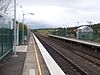 | Southern Highlands Line | 73.320 | 6 September 1869 (original site) 13 June 1892 (present site) | Douglass Park (1869–1891) |
| Dubbo | DBO |  | Western Region | 461.9 | 1881 | |
| Dungog | DGG | 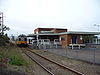 | North Coast Region Hunter Line (Dungog Branch) | 245.200 | 14 August 1911 | |
| East Maitland | EAM |  | Hunter Line | 189.097 | 27 July 1858 (original site) 2 May 1864 (second site) 25 March 1879 (present site) | Morpeth Junction (1858–1879) |
| Euabalong West | EUB |  | Western Region | 617.8 | 1919 | |
| Eungai | ENG |  | North Coast Region | 534 | 1 July 1919 | |
| Exeter | EXT |  | Southern Highlands Line | 155.880 | 1878 | Badgery's Siding (1878–1890) |
| Fairy Meadow | FNW | 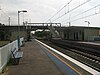 | South Coast Line | 79.360 | 1887 | Cramsville (1887–1888) Para-Meadow (1888–1909) Balgownie (1909–1956) |
| Fassifern | FSN |  | North Coast Region North Western Region Central Coast & Newcastle Line | 142.310 | 1888 (originally) 5 May 1891 (with platform) | |
| Faulconbridge | FLB |  | Blue Mountains Line | 82.960 | 15 March 1877 | |
| Gerringong | 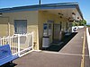 | South Coast Line | 128.560 | 2 June 1893 | ||
| Geurie | GUI | Western Region | 434.50 | 1885 | Ponto (1885-1889) | |
| Glenbrook | GBR |  | Blue Mountains Line | 67.090 (present) | 11 July 1867 (original station) 11 May 1913 (present station) | Watertank (1867–1874) Wascoes Siding (1874–1878) Brookdale (1878–1879) |
| Gloucester | GCR |  | North Coast Region | 309.30 | 5 February 1913 | |
| Gosford | GOS |  | North Coast Region North Western Region Central Coast & Newcastle Line | 80.910 | 15 August 1887 | |
| Goulburn | GUL | 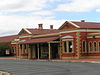 | Southern Region Southern Highlands Line | 224.900 | 19 May 1869 | |
| Grafton | GFN | North Coast Region | 695.70 | 12 October 1915 | ||
| Greta | GTA |  | Hunter Line (Scone Branch) | 210.800 | 6 September 1869 | Farthing (1869–1878) |
| Griffith | GFF |  | Southern Region | 640.38 | 3 July 1916 | |
| Gunnedah | GUH | North Western Region | 475.80 | 11 September 1879 | ||
| Gunning | GNI |  | Southern Region | 278.60 | 9 November 1875 | |
| Hamilton | HAM |  | Central Coast & Newcastle Line Hunter Line | 164.630 | 1872 | |
| Harden | HRD |  | Southern Region | 385.40 | 12 March 1877 | Murrumburrah (1877–1878) North Murrumburrah (1878–1880) |
| Hawkesbury River | HKR |  | Central Coast & Newcastle Line | 57.400 | 1870 | Peats Ferry (1870–1888) Brooklyn (1888–1889) Hawkesbury River (1889–1890) Hawkesbury (1890–1906) |
| Hazelbrook | HZK | 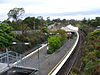 | Blue Mountains Line | 93.470 | 1884 | |
| Helensburgh | HSB |  | South Coast Line | 46.380 | 1 January 1889 (original site) 30 May 1915 (present site) | |
| Henty | HTY |  | Southern Region | 580.29 | 1880 (original station) 1904 (present station) | Doodle Cooma (1880–1891) |
| Hexham | HXM | 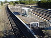 | Hunter Line | 175.530 | 1 August 1871 | |
| High Street | HGH |  | Hunter Line | 191.410 | 27 May 1856 | |
| Hilldale |  | Hunter Line (Dungog Branch) | 226.400 | 14 August 1911 | ||
| Ivanhoe | IVN |  | Western Region | 816.40 | 19 August 1925 | |
| Junee | JUE |  | Southern Region | 485.67 | 6 July 1878 | Junee Junction (1881–1940) |
| Katoomba | KTO |  | Western Region Blue Mountains Line | 109.940 | 2 February 1874 | Crushers (1874–1877) |
| Kembla Grange |  | South Coast Line | 91.590 | 1 January 1890 | ||
| Kempsey | KPS |  | North Coast Region | 503.65 | 3 December 1917 | |
| Kendall | KDL |  | North Coast Region | 433.30 | 12 April 1915 | |
| Kiama |  | South Coast Line | 119.160 | 2 June 1893 | ||
| Koolewong | KWG |  | Central Coast & Newcastle Line | 74.820 | 29 November 1920 | |
| Kootingal | KNG |  | North Western Region | 472.10 | 9 January 1882 | Moonbi (1882–1914) |
| Kotara | KRZ |  | Central Coast & Newcastle Line | 158.920 | 12 November 1924 | |
| Kyogle | KYO | North Coast Region | 833.80 | 25 June 1910 | ||
| Lapstone | LAP |  | Blue Mountains Line | 63.620 | 24 February 1964 | |
| Lawson | LWN |  | Blue Mountains Line | 96.040 | 11 July 1867 | Blue Mountain (1867–1879) |
| Leeton | LEE |  | Southern Region | 612.64 | 6 March 1922 | |
| Leura | LEU |  | Blue Mountains Line | 107.590 | 6 December 1890 | |
| Linden | LND |  | Blue Mountains Line | 86.810 | August 1874 (as tank stop) 26 October 1874 (with platform) | Linden Tank (1874) Henderson's Platform (1874–1879) |
| Lisarow | LRW |  | Central Coast & Newcastle Line | 87.730 | 31 October 1892 | Jenkins Siding (1892–1902) Wyoming (1902) |
| Lithgow | LTH |  | Blue Mountains Line | 155.780 | June 1877 (original site) 9 March 1855 (present site) | |
| Lochinvar | LVR |  | Hunter Line (Scone Branch) | 202.600 | 2 July 1860 | |
| Lysaghts |  | South Coast Line (Port Kembla Branch) | 86.270 | 30 May 1938 | ||
| Macksville | MXV | North Coast Region | 552.4 | 1 July 1919 | ||
| Maitland | MTL |  | North Coast Region North Western Region Hunter Line | 192.550 | 1880 | West Maitland (1880–1949) |
| Martins Creek | MCR |  | Hunter Line (Dungog Branch) | 218.500 | 14 August 1911 | |
| Marulan | MRX |  | Southern Highlands Line | 192.910 | 6 August 1868 | |
| Medlow Bath | MED |  | Blue Mountains Line | 115.800 | 21 January 1880 | Browns Siding Pulpit Hill (1880–1883) Medlow (1883–1903) |
| Melbourne (Southern Cross) | SSS |  | Southern Region 28 non-NSW TrainLink services
| 928 | 17 January 1859 | |
| Menangle | MGE |  | Southern Highlands Line | 65.330 | 1 July 1863 | |
| Menangle Park | MEK |  | Southern Highlands Line | 62.850 | 26 September 1937 | |
| Menindee | MND |  | Western Region | 1006.60 | 15 July 1919 | |
| Metford |  | Hunter Line | 185.120 | 17 March 1995[1] | ||
| Millthorpe |  | Western Region | 302.60 | 1886 | ||
| Mindaribba | MNB |  | Hunter Line (Dungog Branch) | 218.500 | 14 August 1911 | Dunmore (1911–1912) |
| Minnamurra |  | South Coast Line | 113.370 | 23 December 1891 (original site) 10 October 1943 (present site) | ||
| Mittagong | MIT |  | Southern Region Southern Highlands Line | 131.570 | 1 March 1867 | |
| Moree | MRZ |  | North Western Region | 665.60 | 1 April 1897 (original site) 1904 (present site) | |
| Morisset | MOI |  | Central Coast & Newcastle Line | 123.330 | 15 August 1888 | Morrisset (1888–1889) |
| Moss Vale | MSV |  | Southern Region Southern Highlands Line | 145.710 | 2 December 1867 | Sutton Forest (1867–1877) |
| Mount Victoria | MVR |  | Blue Mountains Line | 126.720 | 6 September 1869 | |
| Murrurundi | MDI |  | North Western Region | 352.30 | 4 April 1872 | |
| Muswellbrook | MBK |  | North Western Region Hunter Line (Scone Branch) | 288.800 | 19 May 1869 | Musclebrook (1869–1890) |
| Nambucca Heads | NBH |  | North Coast Region | 565.10 | 3 December 1923 | Nambucca Heads (original), Nambucca (1925–1964) |
| Narara | NRR |  | Central Coast & Newcastle Line | 84.600 | 15 August 1887 | |
| Narrabri | NAA |  | North Western Region | 569.20 | 1 April 1897 | |
| Narrandera | NRA |  | Southern Region | 583.48 | 28 February 1881 | |
| Newcastle Interchange |  | Central Coast & Newcastle Line Hunter Line | 165.60 | 15 October 2017 | ||
| Niagara Park | NIA |  | Central Coast & Newcastle Line | 86.190 | October 1902 | Tundula (1902) |
| North Wollongong | NHW |  | South Coast Line | 81.320 | 19 July 1915 | |
| Oak Flats |  | South Coast Line | 105.130 | 1 January 1890 (originally) 9 March 1925 (with platform) 21 February 2003 (present site) | ||
| Orange | OAG |  | Western Region | 322.6 | 19 April 1877 | |
| Otford | OTF |  | South Coast Line | 52.639 | 3 October 1888 | |
| Ourimbah | OUR |  | Central Coast & Newcastle Line | 90.610 | 15 August 1887 | |
| Parkes | PKE |  | Western Region | 445.5 | 18 December 1893 | |
| Paterson | PTR |  | Hunter Line (Dungog Branch) | 213.200 | 14 August 1911 | |
| Penrose | PRS |  | Southern Highlands Line | 171.400 | 1869 (as siding) 1 June 1871 (original site) 15 March 1916 (present site) | Cables Siding (1869–1871) |
| Picton | PIC |  | Southern Highlands Line | 85.250 | 1 July 1863 | |
| Point Clare | PCL |  | Central Coast & Newcastle Line | 78.050 | 28 June 1891 | |
| Port Kembla |  | South Coast Line (Port Kembla Branch) | 90.240 | 5 January 1920 | ||
| Port Kembla North |  | South Coast Line (Port Kembla Branch) | 88.770 | 9 March 1936 | ||
| Queanbeyan | QBN |  | Southern Region | 321.46 | 8 September 1887 | |
| Quirindi | UIR |  | North Western Region | 392.7 | 13 August 1877 | |
| Rydal | RDL |  | Western Region Blue Mountains Line | 181.4 | 1 July 1870 | |
| Sandgate | SDG |  | Hunter Line | 170.510 | 1881 | |
| Sawtell | SWT |  | North Coast Region | 600.70 | 13 July 1925 | |
| Scarborough | SCB |  | South Coast Line | 62.530 | 21 June 1887 (original site) 15 August 1915 (present site) | Clifton (1887–1888) South Clifton (1888–1903) Scarborough (1903–1915) Clifton (1915–1916) |
| Scone | NSO |  | North Western Region Hunter Line (Scone Branch) | 314.660 | 17 April 1871 | |
| Seymour | SEY |  | Southern Region 3 non-NSW TrainLink services
| 20 November 1872 | ||
| Shellharbour Junction | 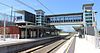 | South Coast Line | 110.660 | 22 November 2014 | Dunmore (Shellharbour) 800 metres away, 9 November 1887 | |
| Singleton | SIX |  | North Western Region Hunter Line (Scone Branch) | 238.900 | 7 May 1863 | |
| Springwood | SPR |  | Blue Mountains Line | 79.670 | 11 July 1867 | |
| Stanwell Park | SWP |  | South Coast Line | 55.950 | 14 March 1890 (original site) 10 October 1920 (present site) | |
| Stuart Town | SWN |  | Western Region | 379.60 | 1 June 1880 | |
| Tahmoor | TAH |  | Southern Highlands Line | 94.490[2] | 13 July 1919[2] | |
| Tallong | TJG |  | Southern Highlands Line | 185.380[3] | 1869 (originally) 16 April 1878 (with platform)[3] | Barbers Creek Tank (1869–1905)[3] |
| Tamworth | TMW |  | North Western Region | 455.1 | 9 January 1882 | |
| Tarago | TGO | 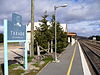 | Southern Region | 282.51 | 3 January 1884 | |
| Tarana | TNJ |  | Western Region Blue Mountains Line | 198.3 | 22 April 1872 | |
| Taree | TRO |  | North Coast Region | 378.60 | 5 February 1913 | |
| Tarro | TRJ |  | Hunter Line | 178.180[4] | 5 April 1857[4] | Hexham (1857–1871) Hexham Township (1871)[4] |
| Tascott | TSC |  | Central Coast & Newcastle Line | 76.910[5] | October 1905[5] | |
| Telarah | TLR |  | Hunter Line (Dungog Branch) | 194.740[6] | 14 August 1911[6] | West Maitland Marshalling Yard (1911–1922)[6] |
| Teralba | TBR |  | Central Coast & Newcastle Line | 147.570[7] | 15 August 1887[8] | |
| The Rock | TRK |  | Southern Region | 550.29 | 1 September 1880 | Hanging Rock (1880–1882) Kingston (1882–1883) |
| Thirroul | TRL |  | South Coast Line | 70.240[9] | 21 June 1887[9] | Robbinsville (1887–1891)[10] |
| Thornton | THO | 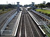 | Hunter Line | 182.190[11] | 1 August 1871[11] | Woodford (1871–1877)[11] |
| Towradgi | TOW | 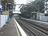 | South Coast Line | 78.020[12] | 18 December 1948[12] | |
| Tuggerah | TGG | 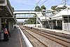 | Central Coast & Newcastle Line | 98.540[13] | 1890[13] | Tuggerah Lakes (1890–1891) Tuggerah (1891–?) Tuggerah Lakes (?–1911)[13] |
| Unanderra |  | South Coast Line | 88.270[14] | 9 November 1887[14] | ||
| Uralla | URL |  | North Western Region | 555.10 | 2 August 1882 | |
| Urunga | URA |  | North Coast Region | 580.90 | 19 March 1923 | |
| Valley Heights | VHS |  | Blue Mountains Line | 77.410[15] | May 1875[15] | Eagers Platform (1875–1877) The Valley (1877–1880)[15] |
| Victoria Street | VST | 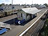 | Hunter Line | 187.920[16] | 5 April 1857[16] | East Maitland (1857–1858) (closed) (1858–1877)[16] |
| Wagga Wagga | WGA | 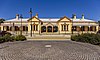 | Southern Region | 521.40 | 1 September 1879 | |
| Walcha Road | WLC |  | North Western Region | 517.9 | 2 August 1882 | |
| Wallarobba | WLB |  | Hunter Line (Dungog Branch) | 231.700[17] | 14 August 1911[17] | |
| Wangaratta | WAG |  | Southern Region 1 non-NSW TrainLink service
| 28 October 1873 | ||
| Warabrook | WBK |  | Hunter Line | 168.690[18] | 23 October 1995[1] | |
| Waratah | WTH |  | Hunter Line | 165.970[19] | 9 March 1858[19] | |
| Warnervale | WNV | 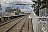 | Central Coast & Newcastle Line | 105.900[20] | 2 September 1907 (originally) 17 October 1910 (with platform)[20] | |
| Warrimoo | WRM |  | Blue Mountains Line | 74.300[21] | 9 March 1918[21] | |
| Wauchope | WAU |  | North Coast Region | 455.00 | 12 April 1915 | |
| Wellington | WEL |  | Western Region | 410.40 | 1 June 1880 | |
| Wentworth Falls | WFS |  | Blue Mountains Line | 102.610[22] | 22 July 1867[22] | Weatherboard (1867–1879)[22] |
| Werris Creek | WCK | 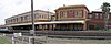 | North Western Region | 410.7 | 1880 | |
| Wingello | WNE |  | Southern Highlands Line | 177.140[23] | 1 June 1871 (as siding) 1882 (as station)[23] | Unnamed (1871–1895)[23] |
| Wingham | WGM |  | North Coast Region | 367.10 | 5 February 1913 | |
| Willow Tree | WTE |  | North Western Region | 375.70 | 13 August 1877 | Warrah (1877–1879) |
| Wirragulla | WGL |  | Hunter Line (Dungog Branch) | 238.000[24] | 14 August 1911[24] | |
| Wollongong | WOL |  | South Coast Line | 82.920[25] | 21 June 1887[25] | |
| Wombarra | WMJ |  | South Coast Line | 64.340[26] | 12 February 1917[26] | |
| Wondabyne | WDB |  | Central Coast & Newcastle Line | 65.150[27] | 1 May 1889 (original site) April 1939 (present site)[27] | Mullet Creek Junction (1889–1890) Hawkesbury Cabin (1890–1891)[27] |
| Woodford | WFO |  | Blue Mountains Line | 90.370[28] | 11 July 1868[28] | Buss's Platform (1868–1871)[28] |
| Woonona | WOJ |  | South Coast Line | 73.990[29] | 25 August 1919[29] | |
| Woy Woy | WOY |  | Central Coast & Newcastle Line | 72.620[30] | 1 February 1889 (originally) 18 December 1891 (with platform)[30] | |
| Wyee | WYE |  | Central Coast & Newcastle Line | 114.860[31] | 1 August 1892 (originally) February 1896 (with platform)[31] | |
| Wyong | WYG |  | Central Coast & Newcastle Line | 101.080[32] | 15 August 1887[32] | |
| Yass Junction | YAS |  | Southern Region | 318.01 | 3 July 1876 | Yass (1876–1882) |
| Yerrinbool | YEB |  | Southern Highlands Line | 116.310[33] | 13 July 1919[33] | |
| Zig Zag | ZIG |  | Blue Mountains Line | 150.940[34] | 15 April 1878 (originally) 1959 (after closure in 1910)[34] |
See also
References
- ^ a b Brian Langton MLA, "Questions and Answers – 491: Railway Station Openings" Archived 24 June 2014 at the Wayback Machine: New South Wales Legislative Assembly, Hansard, 16 April 1996, p. 1006. Retrieved 25 July 2007.
- ^ a b Bozier, Rolfe, "New South Wales Railways: Tahmoor Railway Station. Retrieved 24 July 2007.
- ^ a b c Bozier, Rolfe, "New South Wales Railways: Tallong Railway Station. Retrieved 24 July 2007.
- ^ a b c Bozier, Rolfe, "New South Wales Railways: Tarro Railway Station. Retrieved 24 July 2007.
- ^ a b Bozier, Rolfe, "New South Wales Railways: Tascott Railway Station. Retrieved 24 July 2007.
- ^ a b c Bozier, Rolfe, "New South Wales Railways: Telarah Railway Station. Retrieved 24 July 2007.
- ^ Bozier, Rolfe, "New South Wales Railways: Teralba Railway Station. Retrieved 24 July 2007.
- ^ City of Lake Macquarie, "Local History: History of Teralba". Retrieved 25 July 2014.
- ^ a b Bozier, Rolfe, "New South Wales Railways: Thirroul Railway Station". Retrieved 24 July 2007.
- ^ Forsyth, J.H. (ed.) (1988–93), Stations & Tracks; Vol. 1: "Main Suburban & Branches – Illawarra & Branches". State Rail Authority of New South Wales: Sydney, p. 145.
- ^ a b c Bozier, Rolfe, "New South Wales Railways: Thornton Railway Station. Retrieved 24 July 2007.
- ^ a b Bozier, Rolfe, "New South Wales Railways: Towradgi Railway Station". Retrieved 24 July 2007.
- ^ a b c Bozier, Rolfe, "New South Wales Railways: Tuggerah Railway Station. Retrieved 24 July 2007.
- ^ a b Bozier, Rolfe, "New South Wales Railways: Unanderra Railway Station. Retrieved 24 July 2007.
- ^ a b c Bozier, Rolfe, "New South Wales Railways: Valley Heights Railway Station. Retrieved 24 July 2007.
- ^ a b c Bozier, Rolfe, "New South Wales Railways: Victoria Street Railway Station. Retrieved 24 July 2007.
- ^ a b Bozier, Rolfe, "New South Wales Railways: Wallarobba Railway Station. Retrieved 25 July 2007.
- ^ Bozier, Rolfe, "New South Wales Railways: Warabrook Railway Station. Retrieved 25 July 2007.
- ^ a b Bozier, Rolfe, "New South Wales Railways: Waratah Railway Station. Retrieved 25 July 2007.
- ^ a b Bozier, Rolfe, "New South Wales Railways: Warnervale Railway Station. Retrieved 24 July 2007.
- ^ a b Bozier, Rolfe, "New South Wales Railways: Warrimoo Railway Station. Retrieved 24 July 2007.
- ^ a b c Bozier, Rolfe, "New South Wales Railways: Wentworth Falls Railway Station. Retrieved 24 July 2007.
- ^ a b c Bozier, Rolfe, "New South Wales Railways: Wingello Railway Station. Retrieved 24 July 2007.
- ^ a b Bozier, Rolfe, "New South Wales Railways: Wirragulla Railway Station. Retrieved 25 July 2007.
- ^ a b Bozier, Rolfe, "New South Wales Railways: Wollongong Railway Station. Retrieved 25 July 2007.
- ^ a b Bozier, Rolfe, "New South Wales Railways: Wombarra Railway Station. Retrieved 25 July 2007.
- ^ a b c Bozier, Rolfe, "New South Wales Railways: Wondabyne Railway Station. Retrieved 24 July 2007.
- ^ a b c Bozier, Rolfe, "New South Wales Railways: Woodford Railway Station. Retrieved 24 July 2007.
- ^ a b Bozier, Rolfe, "New South Wales Railways: Woonona Railway Station. Retrieved 25 July 2007.
- ^ a b Bozier, Rolfe, "New South Wales Railways: Woy Woy Railway Station. Retrieved 25 July 2007.
- ^ a b Bozier, Rolfe, "New South Wales Railways: Wyee Railway Station. Retrieved 24 July 2007.
- ^ a b Bozier, Rolfe, "New South Wales Railways: Wyong Railway Station. Retrieved 24 July 2007.
- ^ a b Bozier, Rolfe, "New South Wales Railways: Yerrinbool Railway Station. Retrieved 24 July 2007.
- ^ a b Bozier, Rolfe, "New South Wales Railways: Zig Zag Railway Station. Retrieved 25 July 2007.
- ^ "Main Western Line". NSWrail.net. Retrieved 28 September 2011.
- ^ "Main North Line". NSWrail.net. Retrieved 28 September 2011.
- ^ "South Coast Line". NSWrail.net. Retrieved 28 September 2011.
External links
- Station details – Transport for NSW - Transport for NSW Info website showing details for all stations
- v
- t
- e

- New South Wales
- Northern Territory
- Victoria
- Queensland
- South Australia
- Western Australia
- Tasmania

- Sydney and New South Wales
- Melbourne and Victoria
- Brisbane and South East Queensland
- Adelaide
- Perth and Western Australia
- History
- Narrow-gauge
- Rail gauge
- High-speed rail
- Signalling
- Railway companies
- Former companies
- Former government authorities
- National Faster Rail Agency


