Johan Pienaar Airport
Airport


KMH
Location in the Northern Cape
Show map of Northern Cape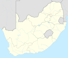
KMH
KMH (South Africa)
Show map of South Africa| Direction | Length | Surface | |
|---|---|---|---|
| m | ft | ||
| 02/20 | 1,700 | 5,578 | Asphalt |
Johan Pienaar Airport (IATA: KMH, ICAO: FAKU) is an airport serving Kuruman, a town in Northern Cape province, South Africa.[1][2]
References
- ^ a b "Airport information for FAKU". World Aero Data. Archived from the original on 5 March 2019.
{{cite web}}: CS1 maint: unfit URL (link) Data current as of October 2006. Source: DAFIF. - ^ a b Airport information for KMH at Great Circle Mapper. Source: DAFIF (effective October 2006).
External links
- Accident history for KMH at Aviation Safety Network
- v
- t
- e


