Ismenius Lacus quadrangle
Map of Mars
47°30′N 330°00′W / 47.5°N 330°W / 47.5; -330 
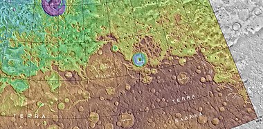
The Ismenius Lacus quadrangle is one of a series of 30 quadrangle maps of Mars used by the United States Geological Survey (USGS) Astrogeology Research Program. The quadrangle is located in the northwestern portion of Mars' eastern hemisphere and covers 0° to 60° east longitude (300° to 360° west longitude) and 30° to 65° north latitude. The quadrangle uses a Lambert conformal conic projection at a nominal scale of 1:5,000,000 (1:5M). The Ismenius Lacus quadrangle is also referred to as MC-5 (Mars Chart-5).[1] The southern and northern borders of the Ismenius Lacus quadrangle are approximately 3,065 km (1,905 mi) and 1,500 km (930 mi) wide, respectively. The north-to-south distance is about 2,050 km (1,270 mi) (slightly less than the length of Greenland).[2] The quadrangle covers an approximate area of 4.9 million square km, or a little over 3% of Mars' surface area.[3] The Ismenius Lacus quadrangle contains parts of Acidalia Planitia, Arabia Terra, Vastitas Borealis, and Terra Sabaea.[4]
The Ismenius Lacus quadrangle contains Deuteronilus Mensae and Protonilus Mensae, two places that are of special interest to scientists. They contain evidence of present and past glacial activity. They also have a landscape unique to Mars, called fretted terrain. The largest crater in the area is Lyot Crater, which contains channels probably carved by liquid water.[5][6]
Origin of names

Ismenius Lacus is the name of a telescopic albedo feature located at 40° N and 30° E on Mars. The term is Latin for Ismenian Lake, and refers to the Ismenian Spring near Thebes in Greece where Cadmus slew the guardian dragon. Cadmus was the legendary founder of Thebes, and had come to the spring to fetch water. The name was approved by the International Astronomical Union (IAU) in 1958.[7]
There appeared to be a large canal in this region called Nilus. Since 1881–1882 it was split into other canals, some were called Nilosyrtis, Protonilus (first Nile),and Deuteronilus (second Nile).[8]
Physiography and geology
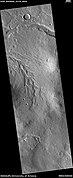
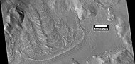
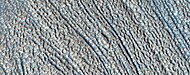
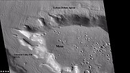
In eastern Ismenius Lacus, lies Mamers Valles, a giant outflow channel.
-
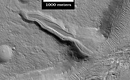
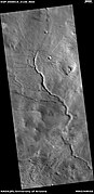
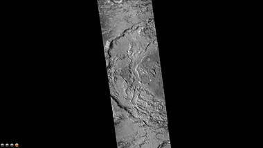
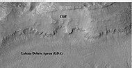
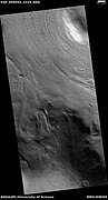
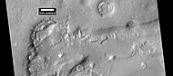
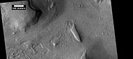
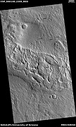
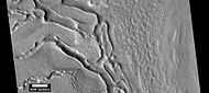
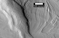
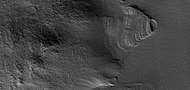
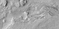
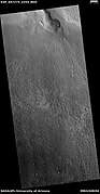
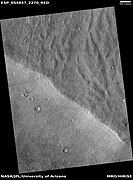
 Wide view of Mamers Vallis with cliffs, as seen by HiRISE
 -
 Smooth cliff of Mamers Valles. Note the lack of boulders. Much of the surface may have just been blown in or dropped from the sky (as dirty frost). Image from HiRISE.
 -
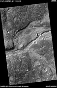
 Layered deposit in Mamers Valles, as seen by HiRISE


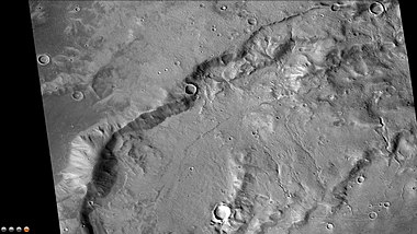
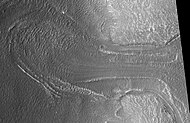
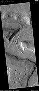
The channel shown below goes quite a long distance and has branches. It ends in a depression that may have been a lake at one time. The first picture is a wide angle, taken with CTX; while the second is a close up taken with HiRISE.[9]
-
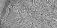
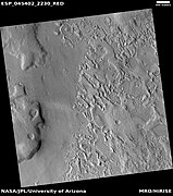
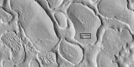
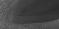
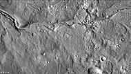 Channels in Arabia, as seen by CTX This channel winds along for a good distance and has branches. It ends in a depression that may have been a lake at one time.
 -
 Channel in Arabia, as seen by HiRISE under HiWish program. This is an enlargement of the previous image that was taken with CTX to give a wide view.
 -
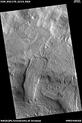
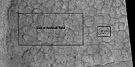
 Channel within larger channel, as seen by HiRISE under HiWish program. The existence of the smaller channel suggests water went through the region at least two times in the past.
 -
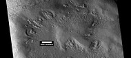
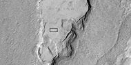
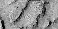
 Close-up of channel within larger channel, as seen by HiRISE under HiWish program. The existence of the smaller channel suggests water went through the region at least two times in the past. The black box represents the size of a football field. Some parts of the surface would be difficult to walk on with the many small hills and depressions.
 -
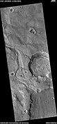
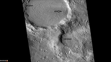
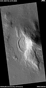
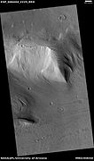
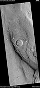
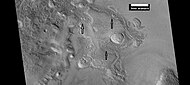
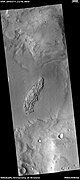
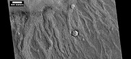
 Channel system that travels through part of a crater, as seen by HiRISE under HiWish program
 -
 Channel that cut through a crater rim, as seen by HiRISE under HiWish program
 -
 Channel system that travels through part of a crater, as seen by HiRISE under HiWish program. Note: this is an enlargement of a previous image.
 -
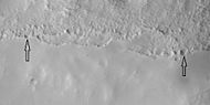
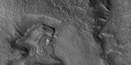
 Channel that travels through part of a crater, as seen by HiRISE under HiWish program. The arrow shows a crater that was eroded by the channel. Note: this is an enlargement of a previous image.
 -
 Channels, as seen by HiRISE under HiWish program
 -
 Meander in a channel, as seen by HiRISE under HiWish program. Meanders are commonly formed in old river systems when the water is moving slowly.
 -
 Wide view of channels, as seen by HiRISE under HiWish program
 -
 Close view of channel, as seen by HiRISE under HiWish program
 -
 Channel that has cut through a crater rim, as seen by HiRISE under HiWish program
 -
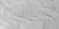
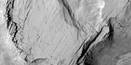
 Wide view of channels, as seen by HiRISE under HiWish program
 -
 Wide view of channels, as seen by HiRISE under HiWish program
 -
 Channel, as seen by HiRISE under HiWish program
 -
 Wide view of channels, as seen by HiRISE under HiWish program
 -
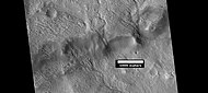
 Channel with hanging valley, as seen by HiRISE under HiWish program
 -
 Wide view of channels, as seen by HiRISE under HiWish program
 -
 Wide view of channels, as seen by HiRISE under HiWish program
 -
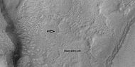
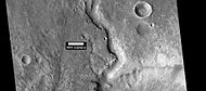 Channel, as seen by HiRISE under HiWish program
 -
 Channels, as seen by HiRISE under HiWish program
 -
 Channels, as seen by HiRISE under HiWish program
 -
 Channels, as seen by HiRISE under HiWish program. Some parts of the image show mantle and others show no mantle covering the surface.
 -
 Possible inverted channel, as seen by HiRISE under HiWish program


Lyot Crater
The northern plains are generally flat and smooth with few craters. However, a few large craters do stand out. The giant impact crater, Lyot, is easy to see in the northern part of Ismenius Lacus.[10] Lyot Crater is the deepest point in Mars's northern hemisphere.[11] One image below of Lyot Crater Dunes shows a variety of interesting forms: dark dunes, light-toned deposits, and dust devil tracks. Dust devils, which resemble miniature tornados create the tracks by removing a thin, but bright deposit of dust to reveal the darker underlying surface. Light-toned deposits are widely believed to contain minerals formed in water. Research, published in June 2010, described evidence for liquid water in Lyot crater in the past.[5][6]
Many channels have been found near Lyot Crater. Research, published in 2017, concluded that the channels were made from water released when the hot ejecta landed on a layer of ice that was 20 to 300 meters thick. Calculations suggest that the ejecta would have had a temperature of at least 250 degrees Fahrenheit. The valleys seem to start from beneath the ejecta near the outer edge of the ejecta. One evidence for this idea is that there are few secondary craters nearby. Few secondary craters were formed because most landed on ice and did not affect the ground below. The ice accumulated in the area when the climate was different. The tilt or obliquity of the axis changes frequently. During periods of greater tilt, ice from the poles is redistributed to the mid-latitudes. The existence of these channels is unusual because although Mars used to have water in rivers, lakes, and an ocean, these features have been dated to the Noachian and Hesperian periods—4 to 3 billion years ago.[12][13][14]
-
 Lyot Crater Gullies, as seen by HiRISE
 -
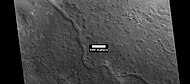
 Lyot Crater Channel, as seen by CTX. Water-carved channels have been spotted in Lyot Crater; the curved line may be one. Click on image for a better view.
 -
 Channels in Lyot Crater, as seen by HiRISE
 -
 Wide view of channels in Lyot Crater, as seen by HiRISE under HiWish program
 -
 Close view of channels in Lyot Crater, as seen by HiRISE under HiWish program
 -
 Close view of channels in Lyot Crater, as seen by HiRISE under HiWish program
 -
 Channel, as seen by HiRISE under HiWish program
 -
 Channel with branches in Lyot Crater, as seen by HiRISE under HiWish program
 -
 Lyot Crater Dunes, as seen by HiRISE. Click on image to see light-toned deposits and dust devil tracks.
 -
 Channel, as seen by HiRISE under HiWish program
 -
 Channel, as seen by HiRISE under HiWish program


Other craters
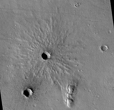
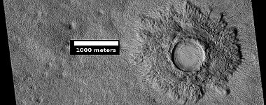
Impact craters generally have a rim with ejecta around them; in contrast volcanic craters usually do not have a rim or ejecta deposits. As craters get larger (greater than 10 km in diameter), they usually have a central peak.[15] The peak is caused by a rebound of the crater floor following the impact.[16] Sometimes craters will display layers in their walls. Since the collision that produces a crater is like a powerful explosion, rocks from deep underground are tossed unto the surface. Hence, craters are useful for showing us what lies deep under the surface.
-
![Possible expanded secondary craters, as seen by HiRISE under HiWish program. These craters may have become much wider, as ice left the ground around the rims.[17][18]](//upload.wikimedia.org/wikipedia/commons/thumb/d/df/ESP_056953_2160expandedcraters.jpg/160px-ESP_056953_2160expandedcraters.jpg)
-
 Fresh crater, as seen by HiRISE under HiWish program. This is a young crater because one can easily see the rim and ejecta. They have not yet been eroded.
 -
 Fresh crater with well-defined ejecta
 -
 Impact crater that may have formed in ice-rich ground, as seen by HiRISE under HiWish program
 -
 Impact crater that may have formed in ice-rich ground, as seen by HiRISE under HiWish program. Note that the ejecta seems lower than the surroundings. The hot ejecta may have caused some of the ice to go away; thus lowering the level of the ejecta.
 -
 Pedestal crater, as seen by HiRISE under HiWish program. The crater's ejecta protected the underlying ground from eroding.
 -
 Pedestal crater, as seen by HiRISE under HiWish program. Mesa on the crater floor formed after the crater.
 -
 Crater with a bench, as seen by HiRISE under HiWish program
![Possible expanded secondary craters, as seen by HiRISE under HiWish program. These craters may have become much wider, as ice left the ground around the rims.[17][18]](http://upload.wikimedia.org/wikipedia/commons/thumb/d/df/ESP_056953_2160expandedcraters.jpg/160px-ESP_056953_2160expandedcraters.jpg)


-
 Valleys on the Ejecta Blanket from Cerulli Crater, as seen by HiRISE
 -
 Cerulli Crater Channels, as seen by THEMIS. Channels are on the inner north rim of the crater.
 -
 Cerulli Crater, as seen by HiRISE
 -
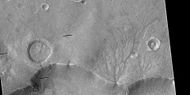
 Semeykin Crater Drainage, as seen by THEMIS. Click on image to see details of beautiful drainage system.
 -
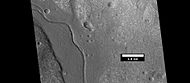
 Western side of Focas Crater, as seen by CTX camera (on Mars Reconnaissance Orbiter)
 -
 Small channels in Focus Crater, as seen by CTX camera (on Mars Reconnaissance Orbiter). Note this is an enlargement of the previous CTX image of Focas Crater.
 -
 Eastern side of Quenisset Crater, as seen by CTX camera (on Mars Reconnaissance Orbiter)
 -
 Northeast rim of Quenisset Crater, as seen by CTX camera (on Mars Reconnaissance Orbiter). Note: this is an enlargement of the previous image of Quenisset Crater. Arrows indicate old glaciers.
 -
 West side of Sinton Crater, as seen by CTX camera (on Mars Reconnaissance Orbiter)
 -
 Channels just to south of Sinton Crater, as seen by CTX camera (on Mars Reconnaissance Orbiter). These were created when the impact occurred in ice-rich ground. Note: this is an enlargement of the previous image of west side of Sinton.
 -
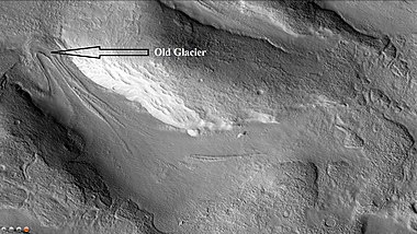 Old glacier just to north of Sinton Crater, as seen by CTX camera (on Mars Reconnaissance Orbiter). This is one of many glaciers in the region. Note: this is an enlargement of a previous image of west side of Sinton.
 -
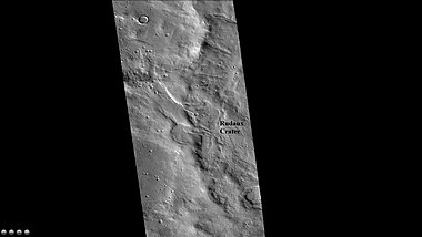
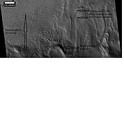
 MOLA map showing Rudaux Crater, and other nearby craters. Colors show elevations.
 -
 West rim of Rudaux Crater, as seen by CTX camera (on Mars Reconnaissance Orbiter)
 -
 Group of layers in crater, as seen by HiRISE under HiWish program
 -
 Wide view of craters with strange deposits, as seen by HiRISE under HiWish program
 -
 Close view of crater with strange, layered deposit, as seen by HiRISE
 -
 Close view of crater with strange layered deposit
 -
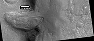
 Double crater. Box shows size of football field. The object broke into two right before striking surface.
 -
 Crater with mesa. First the crater was formed. Later material was deposited in the area. That material was eroded all over, except in this crater.


Fretted terrain
The Ismenius Lacus quadrangle contains several interesting features such as fretted terrain, parts of which are found in Deuteronilus Mensae and Protonilus Mensae. Fretted terrain contains smooth, flat lowlands along with steep cliffs. The scarps or cliffs are usually 1 to 2 km high. Channels in the area have wide, flat floors and steep walls. Many buttes and mesas are present. In fretted terrain the land seems to transition from narrow straight valleys to isolated mesas.[19] Most of the mesas are surrounded by forms that have been called a variety of names: circum-mesa aprons, debris aprons, rock glaciers, and lobate debris aprons.[20] At first they appeared to resemble rock glaciers on Earth. But scientists could not be sure. Even after the Mars Global Surveyor (MGS) Mars Orbiter Camera (MOC) took a variety of pictures of fretted terrain, experts could not tell for sure if material was moving or flowing as it would in an ice-rich deposit (glacier). Eventually, proof of their true nature was discovered by radar studies with the Mars Reconnaissance Orbiter showed that they contain pure water ice covered with a thin layer of rocks that insulated the ice.[21][22]
-
 Fretted terrain of Ismenius Lacus showing flat floored valleys and cliffs. Photo taken with Mars Orbiter Camera (MOC) on the Mars Global Surveyor, under the MOC Public Targeting Program.
 -
 Enlargement of the photo on the left showing cliff. Photo taken with high-resolution camera of Mars Global Surveyor (MGS), under the MOC Public Targeting Program.
 -
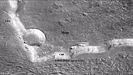 Wide view of mesa with CTX showing cliff face and location of lobate debris apron (LDA). Location is Ismenius Lacus quadrangle.
 -
 Enlargement of previous CTX image of mesa. This image shows the cliff face and detail in the LDA. Image taken with HiRISE under HiWish program. Location is Ismenius Lacus quadrangle.
 -
 Wide CTX view showing mesa and buttes with lobate debris aprons and lineated valley fill around them. Location is Ismenius Lacus quadrangle.
 -
 Close-up of lineated valley fill (LVF), as seen by HiRISE under HiWish program. Note: this is an enlargement of the previous CTX image.
 -
 Example of frettered terrain, as seen by HiRISE under HiWish program. Fretted terrain contains many wide, flat-floored valleys.


Glaciers
Glaciers formed much of the observable surface in large areas of Mars. Much of the area in high latitudes, especially the Ismenius Lacus quadrangle, is believed to still contain enormous amounts of water ice.[16][21][23] In March 2010, scientists released the results of a radar study of an area called Deuteronilus Mensae that found widespread evidence of ice lying beneath a few meters of rock debris.[24] The ice was probably deposited as snowfall during an earlier climate when the poles were tilted more.[25] It would be difficult to take a hike on the fretted terrain where glaciers are common because the surface is folded, pitted, and often covered with linear striations.[26] The striations show the direction of movement. Much of this rough texture is due to sublimation of buried ice. The ice goes directly into a gas (this process is called sublimation) and leaves behind an empty space. Overlying material then collapses into the void.[27] Glaciers are not pure ice; they contain dirt and rocks. At times, they will dump their load of materials into ridges. Such ridges are called moraines. Some places on Mars have groups of ridges that are twisted around; this may have been due to more movement after the ridges were put into place. Sometimes chunks of ice fall from the glacier and get buried in the land surface. When they melt, a more or less round hole remains.[28] On Earth we call these features kettles or kettle holes. Mendon Ponds Park in upstate New York has preserved several of these kettles. The picture from HiRISE below shows possible kettles in Moreux Crater.
-
 The arrow in the left picture points to a possibly valley carved by a glacier. The image on the right shows the valley greatly enlarged in a Mars Global Surveyor image.
 -
 Moreux Crater moraines and kettle holes, as seen by HIRISE
 -
 Clanis and Hypsas Valles, as seen by HiRISE. Ridges are probably due to glacial flow, so water ice is under a thin layer of rocks.
 -
 Glacier moving out of valley, as seen by HiRISE under HiWish program
 -
 Romer Lake's Elephant Foot Glacier in the Earth's Arctic, as seen by Landsat 8. This picture shows several glaciers that have the same shape as many features on Mars that are believed to also be glaciers.
 -
 Glacier coming out of valley, as seen by HiRISE under HiWish program. Location is rim of Moreux Crater.
 -
 Flow, as seen by HiRISE under HiWish program
 -
 Flow, as seen by HiRISE under HiWish program
 -
 Tributary Glacier, as seen by HiRISE
 -
 Glaciers moving form valleys in a mesa, as seen by HiRISE under HiWish program
 -
 Two glaciers interacting, as seen by HiRISE under HiWish program. The one on the left is more recent and is flowing on top of the other one.
 -
 Glacier interacting with an obstacle, as seen by HiRISE under HiWish program
 -
 Glacier flowing out of valley, as seen by HiRISE under HiWish program
 -
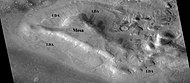
 CTX context image showing location of next HiRISE image (letter A box)
 -
 Possible moraine on the end of a past glacier on a mound in Deuteronilus Mensae, as seen by HiRISE, under the HiWish program. Location of this image is the box labeled A in previous image.
 -
 Ridge that is probably from an old glacier, as seen by HiRISE under HiWish program
 -
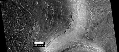
 Coloe Fossae lineated valley fill, as seen by HiRISE. Scale bar is 500 meters long.
 -
 Lineated valley fill, as seen by HiRISE under HiWish program
 -
 Close view of lineated valley fill, as seen by HiRISE under HiWish program
 -
 Close, color view of lineated valley fill, as seen by HiRISE under HiWish program
 -
 Lineated valley fill in valley, as seen by HiRISE under HiWish program
 -
 Lineated valley fill in valley, as seen by HiRISE under HiWish program. Linear valley flow is ice covered by debris.
 -
 Close, color view of lineated valley fill, as seen by HiRISE under HiWish program
 -
 Place where a lobate debris apron begins. Note stripes which indicate movement. Image located in Ismenius Lacus quadrangle. Lobate debris aprons have been shown to contain almost pure water ice covered over with a layer of rocky debris.
 -
 Probable glacier as seen by HiRISE under HiWish program Radar studies have found that it is made up of almost completely pure ice. It appears to be moving from the high ground (a mesa) on the right.
 -
 Mesa in Ismenius Lacus quadrangle, as seen by CTX. Mesa has several glaciers eroding it. One of the glaciers is seen in greater detail in the next two images from HiRISE.
 -
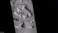
 Glacier as seen by HiRISE under the HiWish program. Area in rectangle is enlarged in the next photo. Zone of accumulation of snow at the top. Glacier is moving down valley, then spreading out on plain. Evidence for flow comes from the many lines on surface. Location is in Protonilus Mensae in Ismenius Lacus quadrangle.
 -
 Enlargement of area in rectangle of the previous image. On Earth the ridge would be called the terminal moraine of an alpine glacier. Picture taken with HiRISE under the HiWish program.
 -
 Flow ridges from a previous glacier, as seen by HiRISE under HiWish program
 -
 Remains of glaciers, as seen by HiRISE under the HiWish program
 -
 Remains of a glacier after ice has disappeared, as seen by HiRISE under HiWish program
 -
 Arrows point to drumlin-like shapes that were probably formed under a glacier, as seen by HiRISE under HiWish program.
 -
 Lobate debris aprons (LDAs) around a mesa, as seen by CTX Mesa and LDAs are labeled so one can see their relationship. Radar studies have determined that LDAs contain ice; therefore these can be important for future colonists of Mars. Location is Ismenius Lacus quadrangle.
 -
 Close-up of lobate debris apron (LDA), as seen by HiRISE under HiWish program
 -
 Wide CTX view of mesa showing lobate debris apron (LDA) and lineated valley fill. Both are believed to be debris-covered glaciers. Location is Ismenius Lacus quadrangle.
 -
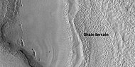
 Close-up of lobate debris apron from the previous CTX image of a mesa. Image shows open-cell brain terrain and closed-cell brain terrain, which is more common. Open-cell brain terrain is thought to hold a core of ice. Image is from HiRISE under HiWish program.
 -
 Lobate debris apron around mesa, as seen by HiRISE under HiWish program
 -
 Close view of lobate debris apron around mesa, as seen by HiRISE under HiWish program. Brain terrain is visible.
 -
 Glaciers moving in two different valleys, as seen by HiRISE under HiWish program
 -
 Wide view of flow moving down valley, as seen by HiRISE under HiWish program
 -
 Close view of part of glacier, as seen by HiRISE under HiWish program. Box shows size of football field.
 -
 Flow and mantle, as seen by HiRISE under HiWish program
 -
 Close, color view of flow, as seen by HiRISE under HiWish program


-
 Wide view of tongue-shaped glacier and lineated valley fill, as seen by HiRISE under HiWish program
 -
 Tongue-shaped glacier, as seen by HiRISE under HiWish program. Note: this is an enlargement of the previous image.
 -
 Close view of tongue-shaped glacier, as seen by HiRISE under HiWish program. Surface is broken up into cubes.


Latitude dependent mantle
Much of the Martian surface is covered with a thick ice-rich, mantle layer that has fallen from the sky a number of times in the past.[29][30][31]
-
 Close view of mantle, as seen by HiRISE under HiWish program. Arrows show craters along edge which highlight the thickness of mantle.
 -
 Close view that displays the thickness of the mantle, as seen by HiRISE under HiWish program
 -
 Mantle and flow, as seen by HiRISE under HiWish program. A part of the image showing the mantle is enlarged in the next image.
 -
 Mantle, as seen by HiRISE under HiWish program
 -
 Close view of mantle, as seen by HiRISE under HiWish program
 -
 Close view of mantle, as seen by HiRISE under HiWish program
 -
 Color view of mantle, as seen by HiRISE under HiWish program. Some parts of the image are covered with mantle; other parts are not.
 -
 Mantle layers, as seen by HiRISE under HiWish program
 -
 Mantle layers, as seen by HiRISE under HiWish program. Mantle layers seem to be forming a group of dipping layers.


Climate change caused ice-rich features
Many features on Mars, especially ones found in the Ismenius Lacus quadrangle, are believed to contain large amounts of ice. The most popular model for the origin of the ice is climate change from large changes in the tilt of the planet's rotational axis. At times the tilt has even been greater than 80 degrees[32][33] Large changes in the tilt explains many ice-rich features on Mars.
Studies have shown that when the tilt of Mars reaches 45 degrees from its current 25 degrees, ice is no longer stable at the poles.[34] Furthermore, at this high tilt, stores of solid carbon dioxide (dry ice) sublimate, thereby increasing the atmospheric pressure. This increased pressure allows more dust to be held in the atmosphere. Moisture in the atmosphere will fall as snow or as ice frozen onto dust grains. Calculations suggest this material will concentrate in the mid-latitudes.[35][36] General circulation models of the Martian atmosphere predict accumulations of ice-rich dust in the same areas where ice-rich features are found.[33] When the tilt begins to return to lower values, the ice sublimates (turns directly to a gas) and leaves behind a lag of dust.[37][38] The lag deposit caps the underlying material so with each cycle of high tilt levels, some ice-rich mantle remains behind.[39] Note that the smooth surface mantle layer probably represents only relative recent material.
Upper Plains Unit
-
 Wide view showing contact between upper plains unit lower part of picture and a lower unit, as seen by CTX
 -
 Contact, as seen by HiRISE under HiWish program Upper plains unit on the left is breaking up. A lower unit exists on the right side of picture.
 -
 Close view of contact, as seen by HiRISE under HiWish program Picture shows details of how upper plains material is breaking. The formation of many fractures seems to precede the break up.


-
 Wide view of upper plains unit eroding into hollows, as seen by HiRISE under HiWish program. Parts of this image are enlarged in following images.
 -
 Close view of upper plain unit eroding into hollows, as seen by HiRISE under HiWish program. Breakup begins with cracks on the surface that expand as more and more ice disappears from the ground.
 -
 Close view of hollows, as seen by HiRISE under HiWish program


Remnants of a 50–100 meter thick mantling, called the Upper Plains Unit, has been discovered in the mid-latitudes of Mars. First investigated in the Deuteronilus Mensae region, but it occurs in other places as well. The remnants consist of sets of dipping layers in craters and along mesas.[40][41] Sets of dipping layers may be of various sizes and shapes—some look like Aztec pyramids from Central America.
-
 Groups of dipping layers near mounds, as seen by HiRISE under HiWish program
 -
 Dipping layers, as seen by HiRISE under HiWish program
 -
 Wide view of dipping layers along mesa walls, as seen by HiRISE under HiWish program
 -
 Close view of dipping layers along a mesa wall, as seen by HiRISE under HiWish program
 -
 Dipping layers, as seen by HiRISE under HiWish program
 -
 Dipping layers in a crater, as seen by HiRISE under HiWish program
 -
 Group of small sets of dipping layers, as seen by HiRISE under HiWish program
 -
 Layered features in crater, as seen by HiRISE under HiWish program
 -
 Layered feature in Red Rocks Park, Colorado. This has a different origin than ones on Mars, but it has a similar shape. Features in Red Rocks region were caused by uplift of mountains.
 -
 Dipping layers, as seen by HiRISE under HiWish program
 -
 Layered structures, as seen by HiRISE under HiWish program
 -
 Layered structures, as seen by HiRISE under HiWish program
 -
 Layered features, as seen by HiRISE under HiWish program
 -
 Layered features in channels and depressions, as seen by HiRISE under HiWish program. Arrows point to some of the layered features.
 -
 Wide view of dipping layers, upper plains unit, and brain terrain, as seen by HiRISE under HiWish program. Parts of this picture are enlarged in other images.
 -
 Dipping layers, as seen by HiRISE under HiWish program. This is an enlargement of a previous image.
 -
 Dipping layers, as seen by HiRISE under HiWish program
 -
 Close view of dipping layers, as seen by HiRISE under HiWish program
 -
 Close view of dipping layers, as seen by HiRISE under HiWish program. Brain terrain is also visible in the image.
 -
 Wide view of dipping layers, as seen by HiRISE under HiWish program
 -
 Wide view of dipping layers, as seen by HiRISE under HiWish program
 -
 Wide view of dipping layers, as seen by HiRISE under HiWish program
 -
 Close view of dipping layers, as seen by HiRISE under HiWish program
 -
 Wide view of dipping layers, as seen by HiRISE under HiWish program
 -
 Close view of dipping layers, as seen by HiRISE under HiWish program
 -
 Close view of dipping layers, as seen by HiRISE under HiWish program
 -
 Wide view of dipping layers, as seen by HiRISE under HiWish program. Gullies are also visible at the bottom of the image.


This unit also degrades into brain terrain. Brain terrain is a region of maze-like ridges 3–5 meters high. Some ridges may consist of an ice core, so they may be sources of water for future colonists.
-
 Brain terrain, as seen by HiRISE under HiWish program
 -
 Layered features, as seen by HiRISE under HiWish program. On the right side of picture a small region of ribbed upper plains material is changing into brain terrain.
 -
 Layered features and brain terrain, as seen by HiRISE under HiWish program. The upper plains unit often changes into brain terrain.
 -
 Brain terrain being formed from a thicker layer, as seen by HiRISE under HiWish program. Arrows show the thicker unit breaking up into small cells.
 -
 Possible glacier surrounded by brain terrain, as seen by HiRISE under HiWish program
 -
 Brain terrain is forming from the breakdown of upper plains unit, as seen by HiRISE under HiWish program. Arrow points to a place where fractures are forming that will turn into brain terrain.
 -
 Brain terrain is forming from the breakdown of upper plains unit, as seen by HiRISE under HiWish program. Arrow points to a place where fractures are forming that will turn into brain terrain.
 -
 Wide view of brain terrain being formed, as seen by HiRISE under HiWish program
 -
 Brain terrain being formed, as seen by HiRISE under HiWish program. Note: this is an enlargement of previous image using HiView.
 -
 Brain terrain being formed, as seen by HiRISE under HiWish program. Note: this is an enlargement of a previous image using HiView.
 -
 Brain terrain being formed, as seen by HiRISE under HiWish program. Note: this is an enlargement of a previous image using HiView. Arrows indicate spots where brain terrain is beginning to form.
 -
 Brain terrain being formed, as seen by HiRISE under HiWish program. Note: this is an enlargement of a previous image using HiView. Arrows indicate spots where brain terrain is beginning to form.
 -
 Brain terrain being formed, as seen by HiRISE under HiWish program. Note: this is an enlargement of a previous image using HiView.
 -
 Wide view of brain terrain being formed, as seen by HiRISE under HiWish program
 -
 Brain terrain being formed, as seen by HiRISE under HiWish program. Note: this is an enlargement of the previous image using HiView.
 -
 Brain terrain being formed, as seen by HiRISE under HiWish program. Note: this is an enlargement of a previous image using HiView.
 -
 Brain terrain with a view from the side, as seen by HiRISE under HiWish program. Arrow shows where a side view of the brain terrain is visible.
 -
 Open and closed brain terrain, as seen by HiRISE under HiWish program
 -
 Open and closed brain terrain with labels, as seen by HiRISE under HiWish program
 -
 Open and closed brain terrain with labels, as seen by HiRISE under HiWish program
 -
 Brain terrain being formed, as seen by HiRISE under HiWish program
 -
 Brain terrain being formed, as seen by HiRISE under HiWish program. Arrows point to locations where the brain terrain is starting to form.
 -
 Brain terrain, as seen by HiRISE under HiWish program


Some regions of the upper plains unit display large fractures and troughs with raised rims; such regions are called ribbed upper plains. Fractures are believed to have started with small cracks from stresses. Stress is suggested to initiate the fracture process since ribbed upper plains are common when debris aprons come together or near the edge of debris aprons—such sites would generate compressional stresses. Cracks exposed more surfaces, and consequently more ice in the material sublimates into the planet's thin atmosphere. Eventually, small cracks become large canyons or troughs.
-
 Well developed ribbed upper plains material. These start with small cracks that expand as ice sublimates from the surfaces of the crack. Picture was taken with HiRISE under HiWish program
 -
 Small and large cracks, as seen by HiRISE under HiWish program The small cracks to the left will enlarge to become much larger dues to sublimation of ground ice. A crack exposes more surface area, hence greatly increases sublimation in the thin Martian air.
 -
 Close-up of canyons from previous image, as seen by HiRISE under HiWish program
 -
 View of stress cracks and larger cracks that have been enlarged by sublimation (ice changing directly into gas). This may be the start of ribbed terrain.
 -
 Evolution of ribbed terrain from stress cracks—cracks to the left eventually will enlarge and become ribbed terrain toward the right side of picture, as seen by HiRISE under HiWish program
 -
 Dipping layers, as seen by HiRISE under HiWish program. Also, Ribbed Upper plains material is visible in the upper right of the picture. It is forming from the upper plains unit, and in turn is being eroded into brain terrain.
 -
 Wide view of ribbed terrain, as seen by HiRISE under HiWish program
 -
 Close view of ribbed terrain, as seen by HiRISE under HiWish program
 -
 Wide view showing ribbed terrain and brain terrain, as seen by HiRISE under HiWish program
 -
 Ribbed terrain being formed from upper plains unit, as seen by HiRISE under HiWish program. Formation begins with cracks that enhance sublimation. Box shows the size of football field.
 -
 Cracks forming on surface and then breaking down, as ice is removed. Picture taken with HiRISE under HiWish program.
 -
 Surface breaking down, as ice is removed, as seen by HiRISE under HiWish program. Box shows size of football field.
 -
 Wide view of terrain caused by ice leaving the ground, as seen by HiRISE under HiWish program
 -
 Close view of terrain caused by ice leaving the ground, as seen by HiRISE under HiWish program
 -
 Wide view of terrain caused by ice leaving the ground, as seen by HiRISE under HiWish program
 -
 Close view of terrain caused by ice leaving the ground, as seen by HiRISE under HiWish program
 -
 Close view of terrain caused by ice leaving the ground, as seen by HiRISE under HiWish program. Box shows size of football field.


Small cracks often contain small pits and chains of pits; these are thought to be from sublimation of ice in the ground.[42][43] Large areas of the Martian surface are loaded with ice that is protected by a meters thick layer of dust and other material. However, if cracks appear, a fresh surface will expose ice to the thin atmosphere.[44][45] In a short time, the ice will disappear into the cold, thin atmosphere in a process called sublimation. Dry ice behaves in a similar fashion on the Earth. On Mars sublimation has been observed when the Phoenix lander uncovered chunks of ice that disappeared in a few days.[46][47] In addition, HiRISE has seen fresh craters with ice at the bottom. After a time, HiRISE saw the ice deposit disappear.[48]
-
![Die-sized clumps of bright material in the enlarged "Dodo-Goldilocks" trench vanished over the course of four days, implying that they were composed of ice which sublimated following exposure.[47][49]](//upload.wikimedia.org/wikipedia/commons/thumb/1/1d/Ice_sublimating_in_the_Dodo-Goldilocks_trench.gif/90px-Ice_sublimating_in_the_Dodo-Goldilocks_trench.gif)
-
 Color versions of the photos showing ice sublimation, with the lower left corner of the trench enlarged in the insets in the upper right of the images
![Die-sized clumps of bright material in the enlarged "Dodo-Goldilocks" trench vanished over the course of four days, implying that they were composed of ice which sublimated following exposure.[47][49]](http://upload.wikimedia.org/wikipedia/commons/thumb/1/1d/Ice_sublimating_in_the_Dodo-Goldilocks_trench.gif/90px-Ice_sublimating_in_the_Dodo-Goldilocks_trench.gif)

The upper plains unit is thought to have fallen from the sky. It drapes various surfaces, as if it fell evenly. As is the case for other mantle deposits, the upper plains unit has layers, is fine-grained, and is ice-rich. It is widespread; it does not seem to have a point source. The surface appearance of some regions of Mars is due to how this unit has degraded. It is a major cause of the surface appearance of lobate debris aprons.[43] The layering of the upper plains mantling unit and other mantling units are believed to be caused by major changes in the planet's climate. Models predict that the obliquity or tilt of the rotational axis has varied from its present 25 degrees to maybe over 80 degrees over geological time. Periods of high tilt will cause the ice in the polar caps to be redistributed and change the amount of dust in the atmosphere.[50][51][52]
Dipping layers
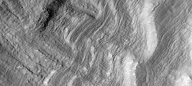
In many locations around Mars are features that have been called "dipping layers" These features are groups of layers in protected place like inside of craters or against slopes. Although they once covered a wide area, today they exist only in certain spots because erosion has removed most of the material. Several ideas have been advanced for how they were formed.[53] The material that formed them may have dropped from the sky as ice-rich dust.[54] [55] [56] Another idea for their origin was presented at 55th LPSC (2024) by an international team of researchers. They suggest that the layers are from past ice sheets.[57]
-
 Wide view of dipping layers, as seen by HiRISE under the HiWish program. The dark strip is where a computer problem is preventing the gathering of data.
 -
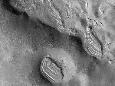
 Group of dipping layers. Each layer represents a change in the Martian climate.
 -
 Remaining parts of a group of dipping layers. Erosion has removed most of the material.
 -
 Close view of dipping layers that show the thin nature of the layers
 -
 Several sets of dipping layers
 -
 Close view of dipping layers Each layer was deposited when the climate changed. These layers only appear in protected areas.


Deltas
Researchers have found a number of examples of deltas that formed in Martian lakes. Deltas are major signs that Mars once had a lot of water because deltas usually require deep water over a long period of time to form. In addition, the water level needs to be stable to keep sediment from washing away. Deltas have been found over a wide geographical range. Below, is a pictures of a one in the Ismenius Lacus quadrangle.[58]
-
 Delta in Ismenius Lacus quadrangle, as seen by THEMIS

Pits and cracks
Some places in the Ismenius Lacus quadrangle display large numbers of cracks and pits. It is widely believed that these are the result of ground ice sublimating (changing directly from a solid to a gas). After the ice leaves, the ground collapses in the shape of pits and cracks. The pits may come first. When enough pits form, they unite to form cracks.[59]
-
 Coloe Fossae Pits, as seen by HiRISE. Pits are believed to result from escaping water.
 -
 CTX Image in Protonilus Mensae, showing location of next image
 -
 Pits in Protonilus Mensae, as seen by HiRISE, under the HiWish program.
 -
 Close-up of pits, as seen by HiRISE under the HiWish program. Resolution is about 30 cm, so one could see a kitchen table if it were in the picture.
 -
 Close-up of patterned ground in a crater deposit, as seen by HiRISE under the HiWish program. Resolution is about 30 cm, so one could see a kitchen table if it were in the picture.
 -
 Close-up of pits forming along the edges of polygons in patterned ground, as seen by HiRISE under the HiWish program. Resolution is about 30 cm, so one could see a kitchen table if it were in the picture.
 -
 Wide view of lines of pits, as seen by HiRISE, under the HiWish program
 -
 Close view of lines of pits, as seen by HiRISE, under the HiWish program Box shows size of football field. Pits may be up to around 50 meters across.
 -
 Close view of lines of pits, as seen by HiRISE, under the HiWish program
 -
 Curved ridges as seen by HiRISE, under the HiWish program
 -
 Close view of pits and polygons, as seen by HiRISE, under the HiWish program. Pits seem to occur in low spots between polygons.
 -
 Wide view of mesas and pits, as seen by HiRISE, under the HiWish program
 -
 Close view of pits and brain terrain, as seen by HiRISE, under the HiWish program
 -
 Close view of pits, as seen by HiRISE, under the HiWish program


Mesas formed by ground collapse
-
 Group of mesas, as seen by HiRISE under HiWish program. Oval box contains mesas that may have moved apart.
 -
 Enlarged view of a group of mesas, as seen by HiRISE under HiWish program. One surface is forming square shapes.
 -
 Mesas breaking up forming straight edges, as seen by HiRISE under HiWish program


Volcanoes under ice
There is evidence that volcanoes sometimes erupt under ice, as they do on Earth at times. What seems to happen it that much ice melts, the water escapes, and then the surface cracks and collapses.[60] These exhibit concentric fractures and large pieces of ground that seemed to have been pulled apart. Sites like this may have recently had held liquid water, hence they may be fruitful places to search for evidence of life.[61][62]
-
![Large group of concentric cracks, as seen by HiRISE, under HiWish program Location is Ismenius Lacus quadrangle. Cracks were formed by a volcano under ice.[61]](//upload.wikimedia.org/wikipedia/commons/thumb/9/93/25755concentriccracks.jpg/190px-25755concentriccracks.jpg) Large group of concentric cracks, as seen by HiRISE, under HiWish program Location is Ismenius Lacus quadrangle. Cracks were formed by a volcano under ice.[61]
Large group of concentric cracks, as seen by HiRISE, under HiWish program Location is Ismenius Lacus quadrangle. Cracks were formed by a volcano under ice.[61] -
 Tilted layers formed when ground collapsed, as seen by HiRISE under HiWish program
 -
 Tilted layers formed from ground collapse, as seen by HiRISE under HiWish program
 -
 Mesas breaking up into blocks, as seen by HiRISE under HiWish program
![Large group of concentric cracks, as seen by HiRISE, under HiWish program Location is Ismenius Lacus quadrangle. Cracks were formed by a volcano under ice.[61]](http://upload.wikimedia.org/wikipedia/commons/thumb/9/93/25755concentriccracks.jpg/190px-25755concentriccracks.jpg)


-
 Wide view of cracked surface and collapse depressions, as seen by HiRISE under HiWish program
 -
 Depression forming from a possible subsurface loss of material, as seen by HiRISE under HiWish program


Exhumed craters
Some features on Mars seem to be in the process of being uncovered. So, the thought is that they formed, were covered over, and now are being exhumed as material is being eroded. These features are quite noticeable with craters. When a crater forms, it will destroy what is under it and leave a rim and ejecta. In the example below, only part of the crater is visible. if the crater came after the layered feature, it would have removed part of the feature.
-
 Wide view of exhumed craters, as seen by HiRISE under HiWish program
 -
 Close view of exhumed crater, as seen by HiRISE under HiWish program. This crater is and was under a set of dipping layers.


Fractures forming blocks
In places large fractures break up surfaces. Sometimes straight edges are formed and large cubes are created by the fractures.
-
 Wide view of mesas that are forming fractures, as seen by HiRISE under HiWish program
 -
 Enlarged view of a part of previous image, as seen by HiRISE under HiWish program. The rectangle represents the size of a football field.
 -
 Close-up of blocks being formed, as seen by HiRISE under HiWish program
 -
 Close-up of blocks being formed, as seen by HiRISE under HiWish program. The rectangle represents the size of a football field, so blocks are the size of buildings.
 -
 Close-up of blocks being formed, as seen by HiRISE under HiWish program. Many long fractures are visible on the surface.
 -
 Surface breaking up, as seen by HiRISE under HiWish program. Near the top the surface is eroding into brain terrain.
 -
 Wide view showing light-toned feature that is breaking into blocks, as seen by HiRISE under HiWish program
 -
 Close view showing blocks being formed, as seen by HiRISE under HiWish program. Note: this is an enlargement of the previous image. Box represents the size of a football field.
 -
 Color view of rocks breaking apart, as seen by HiRISE under HiWish program


Polygonal patterned ground
Polygonal, patterned ground is quite common in some regions of Mars.[63][64][65][66][67][68][69] It is commonly believed to be caused by the sublimation of ice from the ground. Sublimation is the direct change of solid ice to a gas. This is similar to what happens to dry ice on the Earth. Places on Mars that display polygonal ground may indicate where future colonists can find water ice. Patterned ground forms in a mantle layer, called latitude dependent mantle, that fell from the sky when the climate was different.[29][30][70][71]
-
 High-center polygons, as seen by HiRISE under HiWish program. Image is of the top of a debris apron in Deuteronilus Mensae.
 -
 Close-up of field of high center polygons with scale, as seen by HiRISE under HiWish program. Note: the black box is the size of a football field.
 -
 Close-up of high center polygons seen by HiRISE under HiWish program. Note: the black box is the size of a football field.
 -
 Close-up of high center polygons seen by HiRISE under HiWish program. Troughs between polygons are easily visible in this view.
 -
 High center polygons, as seen by HiRISE under HiWish program
 -
 Low center polygons, as seen by HiRISE under HiWish program
 -
 Wide view of high center polygons, as seen by HiRISE under HiWish program
 -
 Close view of high center polygons, as seen by HiRISE under HiWish program. Centers of polygons are labeled.
 -
 Cracked surface and low center polygons, as seen by HiRISE under HiWish program
 -
 Large polygons, as seen by HiRISE under HiWish program


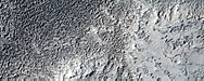
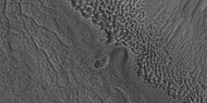
Dunes
Sand dunes have been found in many places on Mars. The presence of dunes shows that the planet has an atmosphere with wind, for dunes require wind to pile up the sand. Most dunes on Mars are black because of the weathering of the volcanic rock basalt.[72][73] Black sand can be found on Earth on Hawaii and on some tropical South Pacific islands.[74] Sand is common on Mars due to the old age of the surface that has allowed rocks to erode into sand. Dunes on Mars have been observed to move many meters.[75][76] Some dunes move along. In this process, sand moves up the windward side and then falls down the leeward side of the dune, thus caused the dune to go toward the leeward side (or slip face).[77] When images are enlarged, some dunes on Mars display ripples on their surfaces.[78] These are caused by sand grains rolling and bouncing up the windward surface of a dune. The bouncing grains tend to land on the windward side of each ripple. The grains do not bounce very high so it does not take much to stop them.
-
 Wide view of dunes in Moreux Crater, as seen by HiRISE under HiWish program
 -
 Enlarged view of dunes on the bottom of the previous image, as seen by HiRISE under HiWish program
 -
 Close view of one large dune from the same location, as seen by HiRISE under HiWish program
 -
 Close view of white spot among the dark dunes showing ripples and streaks


-
 Wide view of a field of dunes, as seen by HiRISE under HiWish program
 -
 Close, color view of dunes, as seen by HiRISE under HiWish program
 -
 Close, color view of dunes, as seen by HiRISE under HiWish program
 -
 Close, color view of dunes, as seen by HiRISE under HiWish program


Ocean
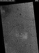
Many researchers have suggested that Mars once had a great ocean in the north.[79][80][81][82][83][84][85] Much evidence for this ocean has been gathered over several decades. New evidence was published in May 2016. A large team of scientists described how some of the surface in Ismenius Lacus quadrangle was altered by two tsunamis. The tsunamis were caused by asteroids striking the ocean. Both were thought to have been strong enough to create 30 km diameter craters. The first tsunami picked up and carried boulders the size of cars or small houses. The backwash from the wave formed channels by rearranging the boulders. The second came in when the ocean was 300 m lower. The second carried a great deal of ice which was dropped in valleys. Calculations show that the average height of the waves would have been 50 m, but the heights would vary from 10 m to 120 m. Numerical simulations show that in this particular part of the ocean two impact craters of the size of 30 km in diameter would form every 30 million years. The implication here is that a great northern ocean may have existed for millions of years. One argument against an ocean has been the lack of shoreline features. These features may have been washed away by these tsunami events. The parts of Mars studied in this research are Chryse Planitia and northwestern Arabia Terra. These tsunamis affected some surfaces in the Ismenius Lacus quadrangle and in the Mare Acidalium quadrangle.[86][87][88][89]
-
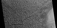
 Channels made by the backwash from tsunamis, as seen by HiRISE. Tsunamis were probably caused by asteroids striking the ocean.
 -
 Channels that may have been made by the backwash of tsunamis in an ocean. Image is from HiRISE under the HiWish program.
 -
 Possible backwash channels that may have been created by a tsunami, as seen by HiRISE under HiWish program
 -
 Boulders that were picked up, carried, and dropped by tsunamis, as seen by HiRISE. Tsunamis were probably caused by asteroids striking ocean. Boulders are between the size of cars and houses.
 -
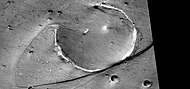 Streamlined promontory eroded by tsunami, as seen by HiRISE. Tsunamis were probably caused by asteroids striking ocean.
 -
 Concentric bands that may have been produced by the waves of a tsunami. Image is from HiRISE under the HiWish program.


Gullies
Gullies were thought for a time to have been caused by recent flows of liquid water. However, further study suggests they are formed today by chunks of dry ice moving down steep slopes.[90]
-
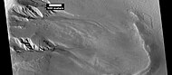 Gullies in crater, as seen by HiRISE under HiWish program
 -
 Wide view of a gully on a steep slope, as seen by HiRISE under HiWish program
 -
 Closer view of previous image of a gully, as seen by HiRISE under HiWish program
 -
 Close view of channel in gully showing streamlined forms, as seen by HiRISE under HiWish program
 - Gullies, as seen by HiRISE under HiWish program
-
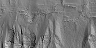 Close view of gullies, as seen by HiRISE under HiWish program
 -
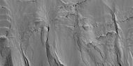 Close view of gullies, as seen by HiRISE under HiWish program


Layered features
-
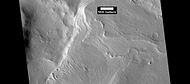 Layers, as seen by HiRISE under HiWish program
 -
 Layered mesas, as seen by HiRISE under HiWish program
 -
 Layers, as seen by HiRISE under HiWish program
 -
 Eroded crater deposits showing layers, as seen by HiRISE under HiWish program
 -
 Layers in depressions, as seen by HiRISE under HiWish program
 -
 Layers, as seen by HiRISE under HiWish program
 -
 Close view of layers, >as seen by HiRISE under HiWish program


Ring mold craters
Ring Mold Craters are a kind of crater on the planet Mars, that look like the ring molds used in baking. They are believed to be caused by an impact into ice. The ice is covered by a layer of debris. They are found in parts of Mars that have buried ice. Laboratory experiments confirm that impacts into ice result in a "ring mold shape." They are also bigger than other craters in which an asteroid impacted solid rock. Impacts into ice warm the ice and cause it to flow into the ring mold shape.
However, another idea for their formation has emerged.[91] The other idea for their formation revolves around the impacting body going through layers of different densities. Later erosion could have helped shape them. It was thought that ring-mold craters could only exist in areas with large amounts of ground ice. However, with more extensive analysis of larger areas, it was found the ring mold craters are sometimes formed where there is not as much ice underground.[92] [93]
-
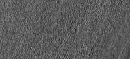 Ring mold craters on floor of a crater, as seen by HiRISE under HiWish program
 -
 Ring mold craters of various sizes on floor of a crater, as seen by HiRISE under HiWish program
 -
 Ring-mold craters form when an impact goes through to an ice layer. The rebound forms the ring-mold shape, and then dust and debris settle on the top to insulate the ice.


-
 Wide view of ring-mold craters, as seen by HiRISE under HiWish program
 -
 Close view of ring-mold crater, as seen by HiRISE under HiWish program
 -
 Group of ring-mold craters, as seen by HiRISE under HiWish program


-
 Wide view of ring-mold craters on floor of larger crater, as seen by HiRISE under HiWish program
 -
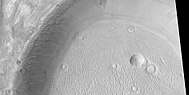 Ring-mold craters, as seen by HiRISE under HiWish program
 -
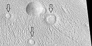 Close view of ring-mold craters and brain terrain, as seen by HiRISE under HiWish program


-
 Close view of ring-mold craters and brain terrain, as seen by HiRISE under HiWish program
 -
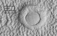 Close view of ring-mold craters and brain terrain, as seen by HiRISE under HiWish program. Rectangle shows size of football field for scale.
 -
 Ring mold crater, as seen by HiRISE under HiWish program


Mounds
-
 Wide view of field of mounds near pedestal crater, as seen by HiRISE under HiWish program
 -
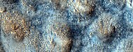 Close, color view of mounds, as seen by HiRISE under HiWish program
 -
 Row of mounds, as seen by HiRISE under HiWish program. Arrows point to some of the mounds.
 -
 Lines of mounds, as seen by HiRISE under HiWish program


Channels
-
 Channels, as seen by HiRISE, under the HiWish program
 -
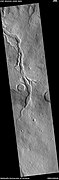 Channels, as seen by HiRISE under HiWish program
 -
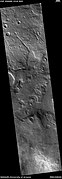 Channels that empty into a low area that could have been a lake, as seen by HiRISE under HiWish program
 -
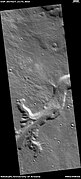 Channels, as seen by HiRISE under HiWish program. The ends of the channels have shapes that suggest they were formed by the process of sapping.
 -
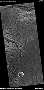 Channels, as seen by HiRISE under HiWish program. These channels are in the ejecta of a crater; hence, they may have formed from warm ejecta melting ground ice.
 -
 Channels, as seen by HiRISE under HiWish program. These channels are near the ejecta of a crater; hence, they may have formed from warm ejecta melting ground ice.
 -
 Channel near ejecta, as seen by HiRISE under HiWish program
 -
 Channels, as seen by HiRISE under HiWish program
 -
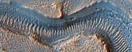 Close view of channel, as seen by HiRISE under HiWish program
 -
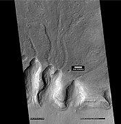 Channels, as seen by HiRISE under HiWish program
 -
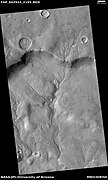 Dendritic channel system, as seen by HiRISE
 -
 Channels with one leading to a lake
 -
 Old stream bed attached to low area that was probably a lake


Landslide
-
 Landslide, as seen by HiRISE under HiWish program
 -
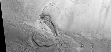 Close view of landslide, as seen by HiRISE under HiWish program
 -
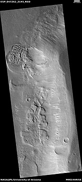 Landslides, as seen by HiRISE under HiWish program
 -
 Type of landslide called a slump along crater wall, as seen by HiRISE under HiWish program Black strip is due to data not collected there.


Other images
-
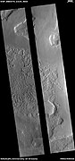 Wide view of terrain with hollows. The hollows were created when ice left the ground. The black strip is due to a malfunction.
 -
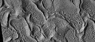 Close view of hollows
 -
 Close view of hollows. Narrow ridges were made when hollows kept expanding.
 -
 Close, color view of hollows. The HiView program was used in the RGB color scheme.
 -
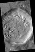 Crater floor with pits, hollows, brain terrain, and ring mold craters. These are formed when ice leaves the ground.
 -
 Wide view of hollows that formed as ice left the ground
 -
 Close view of hollows formed when ice left the ground by sublimation
 -
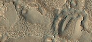 Close view of hollows formed when ice left the ground by sublimation. The ridges were formed when hollows that were next to each other grew in size.
 -
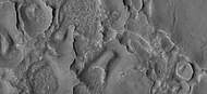 Close view of hollows formed when ice left the ground
 -
 Map of Ismenius Lacus quadrangle which is located just north of Arabia, a large bright area of Mars. It contains large amounts of ice in glaciers that surround hills.
 -
 CTX Context image of Deuteronilus Mensae showing location of next two images
 -
 Eroded terrain in Deuteronilus Mensae, as seen by HiRISE, under the HiWish program
 -
 Another view of eroded terrain in Deuteronilus Mensae, as seen by HiRISE, under the HiWish program
 - CTX context image showing location of next HiRISE image (letter B box)
-
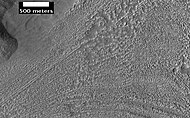 Complex surface around mound in Deuteronilus Mensae, as seen by HiRISE, under the HiWish program. Location of this image is in the black box labeled B in the previous image.
 -
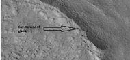 End of a glacier, as seen by HiRISE under HiWish program. Surface to the right of the end moraine exhibits patterned ground which is common where ground water has frozen.
 -
 Surface forms in Ismenius Lacus, as seen by HiRISE under HiWish program
 -
 Hollowed out terrain in Deuteronilus Mensae, as seen by HiRISE under HiWish program
 -
 Hollows in surface, formed as ice is removed from ground, as seen by HiRISE under HiWish program
 -
 Layers visible in nearby craters, as seen by HiRISE under HiWish program. Arrows point to layers.
 -
 Field of pits, as seen by HiRISE under HiWish program
 -
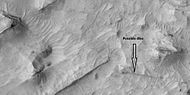 Possible dike, as seen by HiRISE under HiWish program
 -
 Pits and troughs, as seen by HiRISE under HiWish program. Pits may have formed from water/ice leaving the ground.
 -
 Boulders, as seen by HiRISE under HiWish program
 -
 Wide view of contact, as seen by HiRISE under HiWish program
 -
 Close view of contact, as seen by HiRISE under HiWish program
 -
 Possible mud volcanoes, as seen by HiRISE under HiWish program
 -
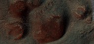 Close view of cones, as seen by HiRISE under HiWish program
 -
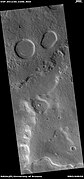 Wide view of possible pingos, as seen by HiRISE under HiWish program. Pingos contain a core of pure ice; they would be useful for a source of water by future colonists.
 -
 Close view of possible pingos, as seen by HiRISE under HiWish program
 -
 Ridges, as seen by HiRISE under HiWish program
 -
 Ridges, as seen by HiRISE under HiWish program
 -
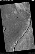 Ridge, as seen by HiRISE under HiWish program. This ridge may be an esker.
 -
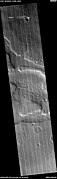 Wide view of honeycomb shapes and possible dikes that make an "X" shape, as seen by HiRISE under HiWish program
 -
 Close view of honeycomb shapes and brain terrain, as seen by HiRISE under HiWish program


Other Mars quadrangles

0°N 180°W / 0°N 180°W / 0; -180
0°N 0°W / 0°N -0°E / 0; -0
90°N 0°W / 90°N -0°E / 90; -0
MC-05
Ismenius Lacus
()
- view
- talk
Interactive Mars map

(See also: Mars Rovers map and Mars Memorial map) (view • discuss)
See also
References
- ^ Davies, M.E.; Batson, R.M.; Wu, S.S.C. "Geodesy and Cartography" in Kieffer, H.H.; Jakosky, B.M.; Snyder, C.W.; Matthews, M.S., Eds. Mars. University of Arizona Press: Tucson, 1992.
- ^ Distances calculated using NASA World Wind measuring tool. http://worldwind.arc.nasa.gov/.
- ^ Approximated by integrating latitudinal strips with area of R^2 (L1-L2)(cos(A)dA) from 30° to 65° latitude; where R = 3889 km, A is latitude, and angles expressed in radians. See: https://stackoverflow.com/questions/1340223/calculating-area-enclosed-by-arbitrary-polygon-on-earths-surface.
- ^ "Planetary Names: Search Results".
- ^ a b Carter, J.; Poulet, F.; Bibring, J.-P.; Murchie, S. (2010). "Detection of Hydrated Silicates in Crustal Outcrops in the Northern Plains of Mars". Science. 328 (5986): 1682–1686. Bibcode:2010Sci...328.1682C. doi:10.1126/science.1189013. PMID 20576889. S2CID 7337256.
- ^ a b http://www.jpl.nasa.gov/news.cfm?release=2010-209[permanent dead link]
- ^ USGS Gazetteer of Planetary Nomenclature. Mars. http://planetarynames.wr.usgs.gov/.
- ^ Blunck, J. 1982. Mars and its Satellites. Exposition Press. Smithtown, N.Y.
- ^ "HiRISE | A Fresh, Shallow Valley in Northern Arabia Terra (ESP_039997_2170)".
- ^ U.S. department of the Interior U.S. Geological Survey, Topographic Map of the Eastern Region of Mars M 15M 0/270 2AT, 1991
- ^ "Mars: What We Know About the Red Planet". Space.com. October 2021.
- ^ Weiss, David K. (2017). "Extensive Amazonian-aged fluvial channels on Mars: Evaluating the role of Lyot crater in their formation". Geophysical Research Letters. 44 (11): 5336–5344. Bibcode:2017GeoRL..44.5336W. doi:10.1002/2017GL073821. S2CID 27711077.
- ^ Weiss, D.; et al. (2017). "Extensive Amazonian-aged fluvial channels on Mars: Evaluating the role of Lyot crater in their formation". Geophysical Research Letters. 44 (11): 5336–5344. Bibcode:2017GeoRL..44.5336W. doi:10.1002/2017GL073821. S2CID 27711077.
- ^ "Hot Rocks Led to Relatively Recent Water-Carved Valleys on Mars - SpaceRef". 14 June 2017.
- ^ "Stones, Wind, and Ice: A Guide to Martian Impact Craters".
- ^ a b Hugh H. Kieffer (1992). Mars. University of Arizona Press. ISBN 978-0-8165-1257-7. Retrieved 7 March 2011.
- ^ http://www.uahirise.org/epo/nuggets/expanded-secondary.pdf [bare URL PDF]
- ^ Viola, D., et al. 2014. "Expanded Craters in Arcadia Planitia: Evidence for >20 MYR Old Subsurface Ice". Eighth International Conference on Mars (2014). 1022pdf.
- ^ Sharp, R. 1973. "Mars Fretted and chaotic terrains". J. Geophys. Res.: 78. 4073–4083
- ^ http://www.lpi.usra.edu/meetings/lpsc2000/pdf/1053.pdf [bare URL PDF]
- ^ a b Plaut, J. et al. 2008. "Radar Evidence for Ice in Lobate Debris Aprons in the Mid-Northern Latitudes of Mars". Lunar and Planetary Science XXXIX. 2290.pdf
- ^ Plaut, J.; Safaeinili, A.; Holt, J.; Phillips, R.; Head, J.; Seu, R.; Putzig, N.; Frigeri, A. (2009). "Radar evidence for ice in lobate debris aprons in the midnorthern latitudes of Mars". Geophys. Res. Lett. 36 (2): n/a. Bibcode:2009GeoRL..36.2203P. doi:10.1029/2008GL036379. S2CID 17530607.
- ^ "European Space Agency". www.esa.int.
- ^ http://news.discovery.com/space/mars-ice-sheet-climate.html [dead link]
- ^ Madeleine, J. et al. 2007. "Exploring the northern mid-latitude glaciation with a general circulation model". In: Seventh International Conference on Mars. Abstract 3096.
- ^ "HiRISE | Glacier? (ESP_018857_2225)". www.uahirise.org.
- ^ "HiRISE | Fretted Terrain Valley Traverse (PSP_009719_2230)".
- ^ "HiRISE | Jumbled Flow Patterns (PSP_006278_2225)". hirise.lpl.arizona.edu.
- ^ a b Hecht, M (2002). "Metastability of water on Mars". Icarus. 156 (2): 373–386. Bibcode:2002Icar..156..373H. doi:10.1006/icar.2001.6794.
- ^ a b Mustard, J.; et al. (2001). "Evidence for recent climate change on Mars from the identification of youthful near-surface ground ice". Nature. 412 (6845): 411–414. Bibcode:2001Natur.412..411M. doi:10.1038/35086515. PMID 11473309. S2CID 4409161.
- ^ Pollack, J.; Colburn, D.; Flaser, F.; Kahn, R.; Carson, C.; Pidek, D. (1979). "Properties and effects of dust suspended in the martian atmosphere". J. Geophys. Res. 84: 2929–2945. Bibcode:1979JGR....84.2929P. doi:10.1029/jb084ib06p02929.
- ^ Touma, J.; Wisdom, J. (1993). "The Chaotic Obliquity of Mars". Science. 259 (5099): 1294–1297. Bibcode:1993Sci...259.1294T. doi:10.1126/science.259.5099.1294. PMID 17732249. S2CID 42933021.
- ^ a b Laskar, J.; Correia, A.; Gastineau, M.; Joutel, F.; Levrard, B.; Robutel, P. (2004). "Long term evolution and chaotic diffusion of the insolation quantities of Mars" (PDF). Icarus. 170 (2): 343–364. Bibcode:2004Icar..170..343L. doi:10.1016/j.icarus.2004.04.005. S2CID 33657806.
- ^ Levy, J.; Head, J.; Marchant, D.; Kowalewski, D. (2008). "Identification of sublimation-type thermal contraction crack polygons at the proposed NASA Phoenix landing site: Implications for substrate properties and climate-driven morphological evolution". Geophys. Res. Lett. 35 (4): L04202. Bibcode:2008GeoRL..35.4202L. doi:10.1029/2007GL032813.
- ^ Levy, J.; Head, J.; Marchant, D. (2009a). "Thermal contraction crack polygons on Mars: Classification, distribution, and climate implications from HiRISE observations". J. Geophys. Res. 114 (E1): E01007. Bibcode:2009JGRE..114.1007L. doi:10.1029/2008JE003273.
- ^ Hauber, E., D. Reiss, M. Ulrich, F. Preusker, F. Trauthan, M. Zanetti, H. Hiesinger, R. Jaumann, L. Johansson, A. Johnsson, S. Van Gaselt, M. Olvmo. 2011. Landscape evolution in Martian mid-latitude regions: insights from analogous periglacial landforms in Svalbard. In: Balme, M., A. Bargery, C. Gallagher, S. Guta (eds). Martian Geomorphology. Geological Society, London. Special Publications: 356. 111–131
- ^ Mellon, M.; Jakosky, B. (1995). "The distribution and behavior of Martian ground ice during past and present epochs". J. Geophys. Res. 100 (E6): 11781–11799. Bibcode:1995JGR...10011781M. doi:10.1029/95je01027. S2CID 129106439.
- ^ Schorghofer, N (2007). "Dynamics of ice ages on Mars". Nature. 449 (7159): 192–194. Bibcode:2007Natur.449..192S. doi:10.1038/nature06082. PMID 17851518. S2CID 4415456.
- ^ Madeleine, J., F. Forget, J. Head, B. Levrard, F. Montmessin. 2007. "Exploring the northern mid-latitude glaciation with a general circulation model". In: Seventh International Conference on Mars. Abstract 3096.
- ^ "HiRISE | Layered Mantling Deposits in the Northern Mid-Latitudes (ESP_048897_2125)". www.uahirise.org.
- ^ Carr, M (2001). "Mars Global Surveyor observations of martian fretted terrain". J. Geophys. Res. 106 (E10): 23571–23593. Bibcode:2001JGR...10623571C. doi:10.1029/2000je001316. S2CID 129715420.
- ^ Morgenstern, A., et al. 2007
- ^ a b Baker, D., J. Head. 2015. Extensive Middle Amazonian mantling of debris aprons and plains in Deuteronilus Mensae, Mars: Implication for the record of mid-latitude glaciation. Icarus: 260, 269–288.
- ^ Mangold, N (2003). "Geomorphic analysis of lobate debris aprons on Mars at Mars Orbiter Camera scale: Evidence for ice sublimation initiated by fractures". J. Geophys. Res. 108 (E4): 8021. Bibcode:2003JGRE..108.8021M. doi:10.1029/2002je001885.
- ^ Levy, J. et al. 2009. Concentric
- ^ "Bright Chunks at Phoenix Lander's Mars Site Must Have Been Ice" Archived 2016-03-04 at the Wayback Machine – Official NASA press release (19.06.2008)
- ^ a b "NASA - Bright Chunks at Phoenix Lander's Mars Site Must Have Been Ice". Archived from the original on 2016-03-04. Retrieved 2015-09-01.
- ^ Byrne, S.; et al. (2009). "Distribution of Mid-Latitude Ground Ice on Mars from New Impact Craters". Science. 325 (5948): 1674–1676. Bibcode:2009Sci...325.1674B. doi:10.1126/science.1175307. PMID 19779195. S2CID 10657508.
- ^ Smith, P.; et al. (2009). "H2O at the Phoenix Landing Site". Science. 325 (5936): 58–61. Bibcode:2009Sci...325...58S. doi:10.1126/science.1172339. PMID 19574383. S2CID 206519214.
- ^ Head, J. et al. 2003.
- ^ Madeleine, et al. 2014.
- ^ Schon; et al. (2009). "A recent ice age on Mars: Evidence for climate oscillations from regional layering in mid-latitude mantling deposits". Geophys. Res. Lett. 36 (15): L15202. Bibcode:2009GeoRL..3615202S. doi:10.1029/2009GL038554.
- ^ R.J. Soare et al. 2013. Sub-kilometre (intra-crater) mounds in Utopia Planitia, Mars: character, occurrence and possible formation hypotheses, Icarus, 225, 982–991.
- ^ Morgenstern, A,, et al. 2007. Deposition and degradation of a volatile-rich layer in Utopia Planitia and implications for climate history on Mars. Journal of Geophysical Research Planets. Volume 112. IssueE6
- ^ Carr, M. 2001. "Mars Global Surveyor observations of martian fretted terrain". J. Geophys. Res. 106, 23571-23593.
- ^ Baker, D., J. Head. 2015. "Extensive Middle Amazonian mantling of debris aprons and plains in Deuteronilus Mensae, Mars: Implication for the record of mid-latitude glaciation". Icarus: 260, 269-288
- ^ Blanc, E., et al. 2024. ORIGIN OF WIDESPREAD LAYERED DEPOSITS ASSOCIATED WITH MARTIAN DEBRIS COVERED GLACIERS. 55th LPSC (2024). 1466.pdf
- ^ Irwin III, R. et al. 2005. "An intense terminal epoch of widespread fluvial activity on early Mars: 2. Increased runoff and paleolake development." Journal of Geophysical Research: 10. E12S15
- ^ "HiRISE | Fretted Terrain Valley Traverse (PSP_009719_2230)". Hirise.lpl.arizona.edu. Retrieved December 19, 2010.
- ^ Smellie, J., B. Edwards. 2016. Glaciovolcanism on Earth and Mars. Cambridge University Press.
- ^ a b Levy, J.; et al. (2017). "Candidate volcanic and impact-induced ice depressions on Mars". Icarus. 285: 185–194. Bibcode:2017Icar..285..185L. doi:10.1016/j.icarus.2016.10.021.
- ^ University of Texas at Austin. "A funnel on Mars could be a place to look for life". ScienceDaily. 10 November 2016. .
- ^ "Refubium - Search" (PDF).
- ^ Kostama, V.-P.; Kreslavsky, Head (2006). "Recent high-latitude icy mantle in the northern plains of Mars: Characteristics and ages of emplacement". Geophys. Res. Lett. 33 (11): L11201. Bibcode:2006GeoRL..3311201K. CiteSeerX 10.1.1.553.1127. doi:10.1029/2006GL025946. S2CID 17229252.
- ^ Malin, M.; Edgett, K. (2001). "Mars Global Surveyor Mars Orbiter Camera: Interplanetary cruise through primary mission". J. Geophys. Res. 106 (E10): 23429–23540. Bibcode:2001JGR...10623429M. doi:10.1029/2000je001455. S2CID 129376333.
- ^ Milliken, R.; et al. (2003). "Viscous flow features on the surface of Mars: Observations from high-resolution Mars Orbiter Camera (MOC) images". J. Geophys. Res. 108 (E6): E6. Bibcode:2003JGRE..108.5057M. doi:10.1029/2002JE002005. S2CID 12628857.
- ^ Mangold, N (2005). "High latitude patterned grounds on Mars: Classification, distribution and climatic control". Icarus. 174 (2): 336–359. Bibcode:2005Icar..174..336M. doi:10.1016/j.icarus.2004.07.030.
- ^ Kreslavsky, M.; Head, J. (2000). "Kilometer-scale roughness on Mars: Results from MOLA data analysis". J. Geophys. Res. 105 (E11): 26695–26712. Bibcode:2000JGR...10526695K. doi:10.1029/2000je001259.
- ^ Seibert, N.; Kargel, J. (2001). "Small-scale martian polygonal terrain: Implications or liquid surface water". Geophys. Res. Lett. 28 (5): 899–902. Bibcode:2001GeoRL..28..899S. doi:10.1029/2000gl012093.
- ^ Kreslavsky, M.A., Head, J.W., 2002. "High-latitude Recent Surface Mantle on Mars: New Results from MOLA and MOC". European Geophysical Society XXVII, Nice.
- ^ Head, J.W.; Mustard, J.F.; Kreslavsky, M.A.; Milliken, R.E.; Marchant, D.R. (2003). "Recent ice ages on Mars". Nature. 426 (6968): 797–802. Bibcode:2003Natur.426..797H. doi:10.1038/nature02114. PMID 14685228. S2CID 2355534.
- ^ "HiRISE | Dunes and Inverted Craters in Arabia Terra (ESP_016459_1830)". hirise.lpl.arizona.edu.
- ^ Michael H. Carr (2006). The surface of Mars. Cambridge University Press. ISBN 978-0-521-87201-0. Retrieved 21 March 2011.
- ^ "Sand Dunes - Phenomena of the Wind - DesertUSA". www.desertusa.com.
- ^ Archived at Ghostarchive and the Wayback Machine: Curiosity Rover Report (Dec. 15, 2015): First Visit to Martian Dunes – via YouTube.
- ^ "The Flowing Sands of Mars". 9 May 2012.
- ^ Namowitz, S., Stone, D. 1975. Earth science the world we live in. American Book Company. New York.
- ^ "NASA Rover's Sand-Dune Studies Yield Surprise". Jet Propulsion Laboratory.
- ^ Parker, T. J.; Gorsline, D. S.; Saunders, R. S.; Pieri, D. C.; Schneeberger, D. M. (1993). "Coastal geomorphology of the Martian northern plains". J. Geophys. Res. 98 (E6): 11061–11078. Bibcode:1993JGR....9811061P. doi:10.1029/93je00618.
- ^ Fairén, A. G.; et al. (2003). "Episodic flood inundations of the northern plains of Mars" (PDF). Icarus. 165 (1): 53–67. Bibcode:2003Icar..165...53F. doi:10.1016/s0019-1035(03)00144-1. Archived from the original (PDF) on 2020-12-10. Retrieved 2018-11-04.
- ^ Head, J. W.; et al. (1999). "Possible ancient oceans on Mars: Evidence from Mars Orbiter Laser Altimeter data". Science. 286 (5447): 2134–2137. Bibcode:1999Sci...286.2134H. doi:10.1126/science.286.5447.2134. PMID 10591640.
- ^ Parker, T. J., Saunders, R. S. & Schneeberger, D. M. Transitional morphology in west Deuteronilus Mensae, Mars: Implications for modification of the lowland/upland boundary" Icarus 1989; 82, 111–145
- ^ Carr, M. H.; Head, J. W. (2003). "Oceans on Mars: An assessment of the observational evidence and possible fate". J. Geophys. Res. 108 (E5): 5042. Bibcode:2003JGRE..108.5042C. doi:10.1029/2002JE001963.
- ^ Kreslavsky, M. A.; Head, J. W. (2002). "Fate of outflow channel effluent in the northern lowlands of Mars: The Vastitas Borealis Formation as a sublimation residue from frozen ponded bodies of water". J. Geophys. Res. 107 (E12): 5121. Bibcode:2002JGRE..107.5121K. doi:10.1029/2001JE001831.
- ^ Clifford, S. M. & Parker, T. J. The evolution of the martian hydrosphere: Implications for the fate of a primordial ocean and the current state of the northern plains" Icarus 2001; 154, 40–79
- ^ "Ancient Tsunami Evidence on Mars Reveals Life Potential" (Press release). May 20, 2016.
- ^ Rodriguez, J.; et al. (2016). "Tsunami waves extensively resurfaced the shorelines of an early Martian ocean". Scientific Reports. 6: 25106. Bibcode:2016NatSR...625106R. doi:10.1038/srep25106. PMC 4872529. PMID 27196957.
- ^ Rodriguez, J. Alexis P.; Fairén, Alberto G.; Tanaka, Kenneth L.; Zarroca, Mario; Linares, Rogelio; Platz, Thomas; Komatsu, Goro; Miyamoto, Hideaki; Kargel, Jeffrey S.; Yan, Jianguo; Gulick, Virginia; Higuchi, Kana; Baker, Victor R.; Glines, Natalie (2016). "Tsunami waves extensively resurfaced the shorelines of an early Martian ocean". Scientific Reports. 6: 25106. Bibcode:2016NatSR...625106R. doi:10.1038/srep25106. PMC 4872529. PMID 27196957.
- ^ Cornell University. "Ancient tsunami evidence on Mars reveals life potential." ScienceDaily, 19 May 2016. https://www.sciencedaily.com/releases/2016/05/160519101756.htm.
- ^ Harrington, J.D.; Webster, Guy (July 10, 2014). "RELEASE 14-191 – NASA Spacecraft Observes Further Evidence of Dry Ice Gullies on Mars". NASA. Retrieved July 10, 2014.
- ^ Baker, D., L. Carter. 2018. Formation of Impact Crater Landforms within Glacial Deposits on Mars. 49th Lunar and Planetary Science Conference 2018 (LPI Contrib. No. 2083). 1589.pdf
- ^ Baker, David M.H.; Carter, Lynn M. (2019). "Probing supraglacial debris on Mars 2: Crater morphology". Icarus. 319: 264–280. Bibcode:2019Icar..319..264B. doi:10.1016/j.icarus.2018.09.009. S2CID 126156734.
- ^ Baker, D. and L. Carter. 2019. Probing supraglacial debris on Mars 2: Crater morphology. Icarus. Volume 319. Pages 264-280
- ^ Morton, Oliver (2002). Mapping Mars: Science, Imagination, and the Birth of a World. New York: Picador USA. p. 98. ISBN 0-312-24551-3.
- ^ "Online Atlas of Mars". Ralphaeschliman.com. Retrieved December 16, 2012.
- ^ "PIA03467: The MGS MOC Wide Angle Map of Mars". Photojournal. NASA / Jet Propulsion Laboratory. February 16, 2002. Retrieved December 16, 2012.
External links
Wikimedia Commons has media related to Ismenius Lacus quadrangle.
- Martian Ice – Jim Secosky – 16th Annual International Mars Society Convention
- T. Gordon Wasilewski - Water on Mars - 20th Annual International Mars Society Convention Describes how to get water from ice in the ground
- Jeffrey Plaut - Subsurface Ice - 21st Annual International Mars Society Convention-2018


Portal:
 Solar System


