Hlobyne
City in Poltava Oblast, Ukraine
You can help expand this article with text translated from the corresponding article in Ukrainian. (February 2022) Click [show] for important translation instructions.
- Machine translation, like DeepL or Google Translate, is a useful starting point for translations, but translators must revise errors as necessary and confirm that the translation is accurate, rather than simply copy-pasting machine-translated text into the English Wikipedia.
- Do not translate text that appears unreliable or low-quality. If possible, verify the text with references provided in the foreign-language article.
- You must provide copyright attribution in the edit summary accompanying your translation by providing an interlanguage link to the source of your translation. A model attribution edit summary is
Content in this edit is translated from the existing Ukrainian Wikipedia article at [[:uk:Глобине]]; see its history for attribution. - You may also add the template
{{Translated|uk|Глобине}}to the talk page. - For more guidance, see Wikipedia:Translation.
City in Poltava Oblast, Ukraine
Hlobyne Глобине | |
|---|---|
 Flag  Coat of arms | |
49°23′25″N 33°15′01″E / 49.39028°N 33.25028°E / 49.39028; 33.25028 | |
| Country |  Ukraine Ukraine |
| Oblast | Poltava Oblast |
| Raion | Kremenchuk Raion |
| Hromada | Hlobyne urban hromada |
| First mentioned | 1725 |
| Population (2022) | |
| • Total | 8,955 |
| Postal code | 39000 |
| Area code | +380 5365 |
| Website | https://globynska-gromada.gov.ua/ |
Hlobyne (Ukrainian: Глобине, pronounced [ˈɦɫɔbɪne]; Russian: Глобино) is a city in Kremenchuk Raion, Poltava Oblast, Ukraine. It hosts the administration of Hlobyne urban hromada, one of the hromadas of Ukraine.[1] Population: 8,955 (2022 estimate).[2]
History
It was a village in Poltava Governorate of the Russian Empire.
During World War II it was occupied by German troops since September 1941 until September 1943. A Nazi concentration camp was established in the buildings of the local sugar factory.[3]
It became an urban-type settlement in April 1957.
City since December 1976.[4][5]
In January 1989 the population was 13 717 people.[6][5]
In January 2013 the population was 10 043 people.[7]
Until 18 July 2020, Hlobyne was the administrative center of Hlobyne Raion. The raion was abolished in July 2020 as part of the administrative reform of Ukraine, which reduced the number of raions of Poltava Oblast to four. The area of Hlobyne Raion was merged into Kremenchuk Raion.[8][9]
Gallery
-
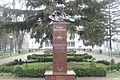 Taras Shevchenko monument
 -
 Cosmonauts Street in Hlobyne


References
- ^ "Глобинская громада" (in Russian). Портал об'єднаних громад України.
- ^ Чисельність наявного населення України на 1 січня 2022 [Number of Present Population of Ukraine, as of January 1, 2022] (PDF) (in Ukrainian and English). Kyiv: State Statistics Service of Ukraine. Archived (PDF) from the original on 4 July 2022.
- ^ Концентрационные лагеря, образованные на территории СССР немецко-фашистскими захватчиками в 1941-1944 гг. Список составлен по материалам Чрезвычайной Государственной Комиссии (ЧГК) // газета "Судьба", июнь 1995. стр.3-6
- ^ Глобино // Советский энциклопедический словарь. редколл., гл. ред. А. М. Прохоров. 4-е изд. М., «Советская энциклопедия», 1986. стр.313
- ^ a b Глобино // Большой энциклопедический словарь (в 2-х тт.). / редколл., гл. ред. А. М. Прохоров. том 1. М., "Советская энциклопедия", 1991. стр.312
- ^ Всесоюзная перепись населения 1989 г. Численность городского населения союзных республик, их территориальных единиц, городских поселений и городских районов по полу
- ^ Чисельність наявного населення України на 1 січня 2013 року. Державна служба статистики України. Київ, 2013. стор.87
- ^ "Про утворення та ліквідацію районів. Постанова Верховної Ради України № 807-ІХ". Голос України (in Ukrainian). 2020-07-18. Retrieved 2020-10-03.
- ^ "Нові райони: карти + склад" (in Ukrainian). Міністерство розвитку громад та територій України.
- v
- t
- e
- Bilotserkivka
- Bilyky
- Chornukhy
- Chutove
- Drabynivka
- Dykanka
- Hadiach
- Hlobyne
- Hoholeve
- Horishni Plavni
- Hradyzk
- Hrebinka
- Kamiani Potoky
- Karlivka
- Khorol
- Kobeliaky
- Kolomatske
- Komyshnia
- Kotelva
- Kozelshchyna
- Krasna Luka
- Kremenchuk
- Lanna
- Liutenka
- Lokhvytsia
- Lubny
- Machukhy
- Martynivka
- Mashivka
- Mykhailivka
- Myrhorod
- Nekhvoroshcha
- Novo Haleshchyna
- Novi Sanzhary
- Novoorzhytske
- Novoselivka
- Obolon
- Omelnyk
- Opishnia
- Orzhytsia
- Petrivka-Romenska
- Pishchane
- Poltava
- Pryshyb
- Pyriatyn
- Reshetylivka
- Romodan
- Semenivka
- Sencha
- Serhiivka
- Shcherbani
- Shyshaky
- Skorokhodove
- Tereshky
- Velyka Bahachka
- Velyka Rublivka
- Velyki Budyshcha
- Velyki Sorochyntsi
- Zavodske
- Zinkiv
| Authority control databases |
|
|---|


