Goldcreek, Montana
Census-designated place in Montana, United States
46°35′5″N 112°55′41″W / 46.58472°N 112.92806°W / 46.58472; -112.92806 (2020)
59733 (Gold Creek)
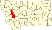
Goldcreek is an unincorporated community and census-designated place (CDP) in Powell County, Montana, United States. It is in the southwestern part of the county, 0.4 miles (0.6 km) south of Interstate 90's Exit 166. Via I-90, Garrison is 8 miles (13 km) to the southeast and Drummond is 12 miles (19 km) to the northwest.
Goldcreek is in the valley of the Clark Fork River, about 1 mile (1.6 km) downstream (west) of the confluence of Gold Creek with the river.
The community was first listed as a CDP prior to the 2020 census.[2]
Demographics
| Census | Pop. | Note | %± |
|---|---|---|---|
| 2020 | 9 | — | |
| U.S. Decennial Census[3] | |||
References
- v
- t
- e
Municipalities and communities of Powell County, Montana, United States
County seat: Deer Lodge
community
- Montana portal
- United States portal
 | This Powell County, Montana state location article is a stub. You can help Wikipedia by expanding it. |
- v
- t
- e


