Deurali, Kaski
Village Development Committee in Gandaki Zone, Nepal
Deurali देउराली | |
|---|---|
Village Development Committee | |
| Deurali | |
| Country |  Nepal Nepal |
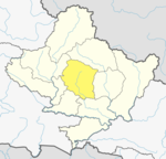
| Zone | Gandaki Zone |
| District | Kaski District |
| Elevation | 3,200 m (10,500 ft) |
| Population (1991) | |
| • Total | 2,882 |
| Time zone | UTC+5:45 (Nepal Time) |
Deurali is a Village Development Committee in Kaski District of the Gandaki province of north-central Nepal. At the time of the 1991 Nepal census, it had a population of 2,882.[1] The base camp of Mount Machapuchare is situated at a 6-hour uphill trek from the village.
Being the furthest human-settled village en route to the Machapuchare base camp, Deurali falls in an avalanche-prone region with the most recent incident of human casualty reported on January 17, 2020.[2]
References
External links
- UN map of the municipalities of Kaski District
- v
- t
- e
Kaski District
Headquarters: Pokhara
- Pokhara
- Arba Vijaya
- Armala
- Begnas
- Bhachok
- Bhadaure Tamagi
- Bhalam
- Bharat Pokhari
- Chapakot
- Dangsing
- Deurali
- Dhampus
- Dhikur Pokhari
- Dhital
- Ghachok
- Ghandruk
- Hansapur
- Hemja
- Kahun
- Kalika
- Kaskikot
- Kristinachnechaur
- Lahachok
- Lamachaur
- Lekhnath Municipality
- Lumle
- Lwangghale
- Machhapuchchhre
- Majhthana
- Mala
- Mauja
- Mijuredanda
- Namarjung
- Nirmalpokhari
- Parche
- Pumdibhumdi
- Puranchaur
- Rakhi
- Ribhan
- Rupakot
- Saimarang
- Salyan
- Sarangkot
- Sardikhola
- Shisuwa
- Siddha
- Sildujure
- Thumakodada
- Thumki
28°7′N 84°10′E / 28.117°N 84.167°E / 28.117; 84.167
 | This article about a location in the Kaski District of Nepal is a stub. You can help Wikipedia by expanding it. |
- v
- t
- e


