Demirköy District
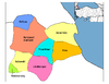
District of Kırklareli Province, Turkey
District in Kırklareli, Turkey
41°49′N 27°46′E / 41.817°N 27.767°E / 41.817; 27.767 (2022)
Demirköy District is a district of the Kırklareli Province of Turkey. Its seat is the town of Demirköy at the Istranca/Yildiz Mountains at the foot of the Mahya Dağı.[1] Its area is 893 km2,[2] and its population is 8,961 (2022).[3] The population of different background merged, and are now called simple Hill people (Dağlılar).
Demirköy Mountains
- Mahya Dağı (1031 m) is the Highest mountain, followed by:[4]
- Karamanbayır Tepesi (995 m)
- Boyunduruk Tepesi (973 m)
- Fatmakaya Tepesi (901 m)
- Kaynak Tepesi (898 m)
- Paraşüt Tepesi (883 m)
- Meşe Tepesi (872 m)
- Haydut Tepesi (860 m)
- Sivritepe (851 m)
- Kaletepe (846 m)
- Bıçkı Tepesi (726 m)
- Çavuştepe (726 m)
- Dalyantepe (725 m)
- Karakoltepe (719 m)
- Bocalar Tepe (680 m)
- Ceviz Tepe (675 m)
- Yangınkulesi Tepe (629 m)
- Yeltepe (618 m)
- Topkoru Tepe (592 m)
- Soğuksu Tepesi (567 m)
- Büyükbezirgan Tepe (412 m)
- Kocataş Tepesi (281 m)
- Koca Tepe (207 m)
References
- ^ İlçe Belediyesi, Turkey Civil Administration Departments Inventory. Retrieved 1 March 2023.
- ^ "İl ve İlçe Yüz ölçümleri". General Directorate of Mapping. Retrieved 1 March 2023.
- ^ "Address-based population registration system (ADNKS) results dated 31 December 2022, Favorite Reports" (XLS). TÜİK. Retrieved 13 March 2023.
- ^ https://peakvisor.com/adm/demirkoey.html
- v
- t
- e
Demirköy District in Kırklareli Province of Turkey
- Babaeski
- Demirköy
- Kırklareli
- Kofçaz
- Lüleburgaz
- Pehlivanköy
- Pınarhisar
- Vize

| Istanbul | |
|---|---|
| West Marmara | |
| Aegean | |
| East Marmara | |
| West Anatolia | |
| Mediterranean | |
| Central Anatolia | |
| West Black Sea | |
| East Black Sea | |
| Northeast Anatolia | |
| Central East Anatolia | |
| Southeast Anatolia | |
Metropolitan municipalities are bolded.


