Capt. John Gunnison House
Historic house in New Hampshire, United States
United States historic place
Capt. John Gunnison House | |
 | |
43°17′36″N 72°7′37″W / 43.29333°N 72.12694°W / 43.29333; -72.12694 | |
| Area | 80 acres (32 ha) |
|---|---|
| Built | 1812 (1812) |
| Architectural style | Federal |
| NRHP reference No. | 79000214[1] |
| Added to NRHP | December 19, 1979 |
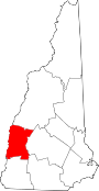
The Capt. John Gunnison House is a historic house on Goshen Center Road in Goshen, New Hampshire. Built in 1812, it is one of the town's finer examples of Federal architecture. It was the childhood home and likely birthplace of John Williams Gunnison, a military officer who led exploratory expeditions in Colorado. The house was listed on the National Register of Historic Places in 1979.[1]
Description and history
The Captain John Gunnison House is located in a rural setting of central Goshen, on the north side of Goshen Center Road about 1 mile (1.6 km) east of New Hampshire Route 31. It is a two-story wood-frame structure, with a hip roof and clapboarded exterior. Its main facade has five bays, with the door centered, with flanking sidelight windows and a false fanlight above. A single-story porch extends across the center three bays, supported by round columns. Two interior chimneys rise behind the main roof ridge, and only one of its original four fireplaces survives. The interior includes a number of 19th-century features, including stencilwork and feather painting.[2]
The house was built in 1812 on an 80-acre (32 ha) parcel that was one of the first to be granted in the town, to Samuel Gunnison. Explorer John Williams Gunnison was born in 1812, so this may have been the place of his birth. Gunnison was killed by Native Americans in 1853 during an exploratory expedition in what is now Utah. Geographic features in Colorado, where he also led expeditions, bear his name. The house was sold out of the Gunnison family by 1890.[2]
See also
References
- ^ a b "National Register Information System". National Register of Historic Places. National Park Service. July 9, 2010.
- ^ a b "NRHP nomination for Capt. John Gunnison House". National Park Service. Retrieved 2014-06-28.
- v
- t
- e
- Central Business District
- Charlestown Main Street Historic District
- Lower Village District
- Monadnock Mills
- Newport Downtown Historic District
- North Charlestown Historic District
- Washington Common Historic District
- Acworth Silsby Library
- Backside Inn
- Blow-Me-Down Grange
- Charlestown Town Hall
- Claremont City Hall
- Claremont Warehouse No. 34
- Farwell School
- Little Red School House 1835 District No. 7
- Meriden Town Hall
- Mothers' and Daughters' Club House
- Plainfield Town Hall
- Protectworth Tavern
- Richards Free Library
- Richards, Dexter, & Sons Woolen Mill
- Sullivan County Courthouse
- Town Hall and Courthouse
- Unity Town Hall
- Burford House
- Capt. John Gunnison House
- Cote House
- Covit House
- David Dexter House
- Durham House
- Garber House
- Giffin House
- Isaac Reed House
- Janicke House
- Knights-Morey House
- Lear House
- Louis St. Gaudens House and Studio
- Nettleton House
- Pike House
- Purnell House
- Scranton House
- Seavey House
- Stelljes House
- Welcome Acres
- William Rossiter House
- Williamson House
- Windswept Acres-Powers House
worship
- Acworth Congregational Church
- English Church
- First Baptist Church of Cornish
- First Universalist Chapel
- Langdon Meeting House
- Lempster Meetinghouse
- South Congregational Church
- Springfield Town Hall and Howard Memorial Methodist Church
- Trinity Church
‡ This historic property also has portions in an adjacent state.
Entries in italics have been removed from the register.
Entries in italics have been removed from the register.


