Bunibonibee Cree Nation


Oxford House
class=notpageimage|
Location of Oxford House in ManitobaBunibonibee Cree Nation (Cree: ᐸᓂᑇᓂᐱᐩ, panipwânipiy), formerly known as Oxford House First Nation and as Oxford House Band of Indians, is a First Nation located along the eastern shoreline of Oxford Lake at the headwaters of the Hayes River and is approximately 950 kilometres (590 mi) northeast of Winnipeg, Manitoba.
The residents are predominantly Woodland Cree and, more specifically Rocky Cree (Asinīskāwiyiniwak). The First Nation is a signatory to the 1909 Treaty 5 Adhesion. Bunibonibee Cree Nation has offices in Oxford House, Manitoba.
The registered population as of August 2013 was 2,892, of which 2,424 resided on their own Indian reserve.[1]
Governance
The First Nation's governing council are elected under the Indian Act Electoral System, Section 74, of the Indian Act of Canada. consisting of a Chief and six Councillors for a four-year term. The current administration, whose term expires December 4, 2023, are Chief Richard Hart, and Councillors Howard Grieves Jr, Donald Hart, Marion Wood, Anthony Weenusk, Paul Weenusk Sr, and an unfilled Councillor position due to the death of Gabriel Hart on April 16, 2021.
The band council of Bunibonibee Cree Nation, in turn, is a member of Keewatin Tribal Council (KTC), a regional technical/political council;[2] Manitoba Keewatinowi Okimakanak (MKO), a northern regional political council; the Assembly of Manitoba Chiefs (AMC), the provincial political council; and Assembly of First Nations (AFN), the federal political council.
Indian Reserves
The First Nation have reserved for themselves 13 separate tracts, of which Oxford House 24 IR serves as their main reserve, containing the Settlement of Oxford House, Manitoba.
- High Hill Lake IR — 422 hectares (1,040 acres)
- Kisipikamak IR — 1,879 hectares (4,640 acres)
- Munro Lake IR — 1,491 hectares (3,680 acres)
- Notin Sakahekun IR — 2,822.40 hectares (6,974.3 acres)
- Opischikonayak Nation IR — 254.80 hectares (629.6 acres)
- Oxford House 24 IR — 4,876.20 hectares (12,049.4 acres)
- Oxford House 24A IR — 146 hectares (360 acres)
- Oxford House 24B IR — 1,737.60 hectares (4,293.7 acres)
- Oxford House 24C IR — 402 hectares (990 acres)
- Oxford House 24D IR — 4.50 hectares (11.1 acres)
- Oxford Lake North Shore IR — 1,385 hectares (3,420 acres)
- Wapisew Lake IR — 71 hectares (180 acres)
- Whitemud Lake IR — 2,068 hectares (5,110 acres)
References
- ^ "AANDC (First Nation Profiles) Bunibonibee Cree Nation". Crown–Indigenous Relations and Northern Affairs Canada. Government of Canada. 2013-09-15.
- ^ "Keewatin Tribal Council website". 2013-09-15.
External links
- Bunibonibee Cree Nation profile at Keewatin Tribal Council
- Bunibonibee Cree Nation profile at Indian and Northern Affairs Canada
- Community profile at Kitayan CFDC
- Oxford House at Weather Network
- Map of Oxford House 24 at Statcan
54°55′00″N 95°19′49″W / 54.91667°N 95.33028°W / 54.91667; -95.33028
- v
- t
- e
First Nations in the Northern Region of Manitoba
- Barren Lands First Nation
- Berens River First Nation
- Black River First Nation
- Bloodvein First Nation
- Bunibonibee Cree Nation
- Chemawawin Cree Nation
- Cross Lake First Nation
- Fisher River Cree Nation
- Fox Lake Cree Nation
- Garden Hill First Nation
- God's Lake First Nation
- Hollow Water First Nation
- Kinonjeoshtegon First Nation
- Little Grand Rapids First Nation
- Manto Sipi Cree Nation
- Mathias Colomb First Nation
- Marcel Colomb First Nation
- Misipawistik Cree Nation
- Mosakahiken Cree Nation
- Nisichawayasihk Cree Nation
- Northlands First Nation
- Norway House Cree Nation
- O-Chi-Chak-Ko-Sipi First Nation
- Opaskwayak Cree Nation
- Pauingassi First Nation
- Peguis First Nation
- Poplar River First Nation
- Red Sucker Lake First Nation
- Sayisi Dene First Nation
- Shamattawa First Nation
- Skownan First Nation
- St. Theresa Point First Nation
- Tataskweyak Cree Nation
- War Lake First Nation
- Wasagamack First Nation
| ||
|---|---|---|
| Cities | 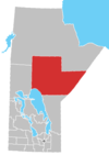 | |
| Local government districts | ||
| First Nations | ||
| Indian reserves | ||
| Indian settlements | ||
| Unorganized areas | ||
| Unincorporated communities | ||
Authority control databases | |
|---|---|
| International |
|
| National |
|


