Bruck-Mürzzuschlag District
District in Styria, Austria
Bruck-Mürzzuschlag District Bezirk Bruck-Mürzzuschlag | |
|---|---|
District | |
 | |
| Country | Austria |
| Federal state | Styria |
| Number of municipalities | 19 |
| Area | |
| • Total | 2,155 km2 (832 sq mi) |
| Population (1 January 2016) | |
| • Total | 100,306 |
| • Density | 47/km2 (120/sq mi) |
| Time zone | UTC+01:00 (CET) |
| • Summer (DST) | UTC+02:00 (CEST) |
| NUTS code | AT223 |
Bruck-Mürzzuschlag (German: [bʁʊk myɐ̯t͡sˈt͡suːʃlak]) is a district in Styria, Austria. It came into effect on January 1, 2013, when the merging of the districts Bruck an der Mur and Mürzzuschlag occurred.[1] Just 2 years later, on 1 January 2015, the district was restructured in the Styria municipal structural reform and reduced from 37 to 19 towns. It consists of the following 19 municipalities:[2]
- Aflenz
- Breitenau am Hochlantsch
- Bruck an der Mur
- Kapfenberg
- Kindberg
- Krieglach
- Langenwang
- Mariazell
- Mürzzuschlag
- Neuberg an der Mürz
- Pernegg an der Mur
- Sankt Barbara im Mürztal
- Sankt Lorenzen im Mürztal
- Sankt Marein im Mürztal
- Spital am Semmering
- Stanz im Mürztal
- Thörl
- Tragöß-Sankt Katharein
- Turnau
Prior district before 2015
Up until 1 January 2015, the district contained the following 37 municipalities:
- Aflenz Kurort
- Aflenz Land
- Allerheiligen im Mürztal
- Altenberg an der Rax
- Breitenau am Hochlantsch
- Bruck an der Mur
- Etmißl
- Frauenberg
- Ganz
- Gußwerk
- Halltal
- Kapellen
- Kapfenberg
- Kindberg
- Krieglach
- Langenwang
- Mariazell
- Mitterdorf im Mürztal
- Mürzhofen
- Mürzsteg
- Mürzzuschlag
- Neuberg an der Mürz
- Oberaich
- Parschlug
- Pernegg an der Mur
- Sankt Ilgen
- Sankt Katharein an der Laming
- Sankt Lorenzen im Mürztal
- Sankt Marein im Mürztal
- Sankt Sebastian
- Spital am Semmering
- Stanz im Mürztal
- Thörl
- Tragöß
- Turnau
- Veitsch
- Wartberg im Mürztal
Wikimedia Commons has media related to Bezirk Bruck-Mürzzuschlag.
References
- v
- t
- e
 Cities and districts (Bezirke) of Styria
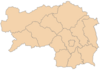
- Bruck-Mürzzuschlag
- Deutschlandsberg
- Graz-Umgebung
- Hartberg-Fürstenfeld
- Leibnitz
- Leoben
- Liezen
- Murau
- Murtal
- Südoststeiermark
- Voitsberg
- Weiz
Authority control databases | |
|---|---|
| International |
|
| National |
|
47°25′00″N 15°16′00″E / 47.4167°N 15.2667°E / 47.4167; 15.2667
 | This Austrian location article is a stub. You can help Wikipedia by expanding it. |
- v
- t
- e


