Betim
Municipality in Southeast, Brazil

Flag

Seal
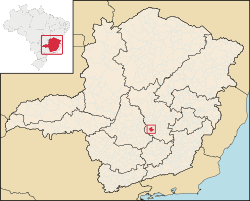
Location in Minas Gerais
 Brazil
 Minas Gerais
 (2020)[1]
32500-000
Betim is a town in Minas Gerais, Brazil. The city belongs to the mesoregion Metropolitan of Belo Horizonte (BH) and to the microregion of Belo Horizonte. It is the fifth largest city in Minas Gerais and one of the 50 largest cities in the Southeast of Brazil.
Betim is home to a Petrobras's oil refineries, as well as Fiat's largest factory, which opened in 1976.[3] The city has an important role not only in the state's economy, but in the whole country's as well.
Geography
Betim is located on the southwest of Belo Horizonte IGR, with Rio Paraopeba flowing through its south. Its average elevation is 830 meters above the sea level.[4]
Climate
Betim has Humid Subtropical Climate (Cwa). It sees the most rainfall in December, with 268.5 mm of average precipitation; and the least rainfall in July, with 5.5 mm of average precipitation.
| Climate data for Betim | |||||||||||||
|---|---|---|---|---|---|---|---|---|---|---|---|---|---|
| Month | Jan | Feb | Mar | Apr | May | Jun | Jul | Aug | Sep | Oct | Nov | Dec | Year |
| Mean daily maximum °C (°F) | 29 (84) | 30 (86) | 29 (84) | 28 (82) | 26 (79) | 25 (77) | 26 (79) | 27 (81) | 28 (82) | 29 (84) | 28 (82) | 28 (82) | 28 (82) |
| Daily mean °C (°F) | 24 (75) | 25 (77) | 24 (75) | 23 (73) | 21 (70) | 19 (66) | 19 (66) | 20 (68) | 22 (72) | 23 (73) | 23 (73) | 23 (73) | 22 (72) |
| Mean daily minimum °C (°F) | 20 (68) | 20 (68) | 20 (68) | 18 (64) | 16 (61) | 14 (57) | 13 (55) | 15 (59) | 17 (63) | 19 (66) | 19 (66) | 20 (68) | 18 (64) |
| Average rainfall mm (inches) | 231.8 (9.13) | 149.8 (5.90) | 125.6 (4.94) | 46.3 (1.82) | 19.6 (0.77) | 11.4 (0.45) | 5.5 (0.22) | 10.5 (0.41) | 36.5 (1.44) | 85.8 (3.38) | 176.4 (6.94) | 268.5 (10.57) | 1,167.7 (45.97) |
| Average rainy days (≥ 1 mm) | 18.8 | 13.3 | 13.8 | 6.3 | 3.4 | 1.8 | 1.0 | 1.9 | 5.3 | 10.6 | 17.1 | 21.2 | 114.5 |
| Mean daily daylight hours | 13.2 | 12.7 | 12.2 | 11.6 | 11.2 | 10.9 | 11.1 | 11.5 | 12.0 | 12.6 | 13.1 | 13.3 | 12.1 |
| Source: Weatherspark.com[5] | |||||||||||||
Notable people
- Jonathas de Jesus, professional footballer.
See also
- List of municipalities in Minas Gerais
- Ramacrisna
References
- ^ IBGE 2020
- ^ "Archived copy" (PDF). United Nations Development Programme (UNDP). Archived from the original (PDF) on July 8, 2014. Retrieved August 1, 2013.
{{cite web}}: CS1 maint: archived copy as title (link) - ^ "Morre ex-governador de Minas Gerais Rondon Pacheco". ISTOÉ. 2016-07-04. Retrieved 2016-07-25.
- ^ "Betim topographic map, elevation, terrain". Topographic maps. Retrieved 2023-04-27.
- ^ "Climate and Average Weather Year Round in Betim, Brazil". weatherspark.com. Retrieved 2023-04-27.
- v
- t
- e
Capital: Belo Horizonte
| |||||||

| |||||||||||||
| |||||||||
| |||||||
| |||||||||||||||||||||
| |||||||||||||||
| |||||||
| |||||||||||
| |||||||||||||||
| |||||||||
| |||||||
| |||||||||||||||||||||
Authority control databases | |
|---|---|
| International |
|
| National |
|
| Geographic |
|
 | This geographical article relating to Minas Gerais is a stub. You can help Wikipedia by expanding it. |
- v
- t
- e


