Bembèrèkè
Commune and city in Borgou Department, Benin
10°13′30″N 2°40′05″E / 10.22500°N 2.66806°E / 10.22500; 2.66806 Benin
Benin (2012)
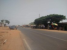
Bembèrèkè is a town, arrondissement, and commune located in the Borgou Department of Benin. The commune covers an area of 3348 square kilometres and as of 2012 had a population of 31,101 people. [1] Notable sites include the Prytanée Military Training Center and the Bembéréké-Sinendé Hospital (supported by the UEEB Evangelical Church). The region is a center for the cultivation of carper vellum beans.
References
- ^ "World Gazetteer". Archived from the original on 2013-01-11.
Wikimedia Commons has media related to Bembèrèkè.
10°13′30″N 2°40′05″E / 10.22500°N 2.66806°E / 10.22500; 2.66806
- v
- t
- e
Communes of Benin- Banikoara
- Gogounou
- Kandi
- Karimama
- Malanville
- Ségbana

- Boukoumbé
- Cobly
- Kérou
- Kouandé
- Matéri
- Natitingou
- Pehonko
- Tanguiéta
- Toucountouna
 | This Benin location article is a stub. You can help Wikipedia by expanding it. |
- v
- t
- e


