Alma, Oklahoma
Unincorporated community in Oklahoma, United States
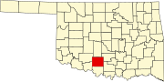
34°25′10″N 97°36′44″W / 34.41944°N 97.61222°W / 34.41944; -97.61222Alma is a rural community located in southwestern Stephens County, Oklahoma, United States. The Alma Post Office, said to be named for Alma Peeples (an early-day resident),[2] was opened February 14, 1906.
At the time of its founding, Alma was located in Pickens County, Chickasaw Nation.[3]
The Alma School District was consolidated with the one at Velma.[4]
References
- ^ a b U.S. Geological Survey Geographic Names Information System: Alma, Oklahoma
- ^ Shirk, George H. Oklahoma Place Names, Norman: University of Oklahoma Press, 1987 ISBN 0-8061-2028-2
- ^ Charles Goins, Historical Atlas of Oklahoma (Norman: University of Oklahoma Press, 2006), plate 105.
- ^ http://velma-alma.com/ Velma-Alma Schools
- v
- t
- e
Municipalities and communities of Stephens County, Oklahoma, United States
County seat: Duncan
- Comanche
- Duncan
- Marlow
- Bray
- Central High
- Empire City
- Loco
- Velma
communities
‡This populated place also has portions in an adjacent county or counties
- Oklahoma portal
- United States portal
 | This Oklahoma state location article is a stub. You can help Wikipedia by expanding it. |
- v
- t
- e


