A980 road
Road in Scotland
 | |
|---|---|
 | |
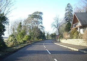 The A980 heading west from Torphins | |
| Route information | |
| Length | 20.6 mi[1] (33.2 km) |
| Location | |
| Country | United Kingdom |
| Constituent country | Scotland |
| Road network | |
The A980 road is a relatively short 20.6-mile (33.2 km) main road in north-east Scotland.
The A980 connects the A944 road with the trunk A93 road.
Route
- North to South
- A944 between Alford, Aberdeenshire and Bridge of Alford
- Muir of Fowlis
- Craigievar Castle
- Crossroads
- Lumphanan
- Torphins
- Milltown of Campfield
- Banchory, junction with the A93
References
- ^ "Driving directions to A980". Google Maps. Retrieved 21 September 2013.
External links
Wikimedia Commons has media related to A980 road (Scotland).
- Its entry in SABRE
- Article in GEOGRAPH
Portals:
 Roads
Roads Scotland


57°08′47″N 2°43′26″W / 57.14632°N 2.72401°W / 57.14632; -2.72401
 | This Scotland road or road transport-related article is a stub. You can help Wikipedia by expanding it. |
- v
- t
- e


