Çiğli Air Base
Military airbase in Izmir, Turkey
You can help expand this article with text translated from the corresponding article in Turkish. (November 2020) Click [show] for important translation instructions.
- View a machine-translated version of the Turkish article.
- Machine translation, like DeepL or Google Translate, is a useful starting point for translations, but translators must revise errors as necessary and confirm that the translation is accurate, rather than simply copy-pasting machine-translated text into the English Wikipedia.
- Consider adding a topic to this template: there are already 494 articles in the main category, and specifying
|topic=will aid in categorization. - Do not translate text that appears unreliable or low-quality. If possible, verify the text with references provided in the foreign-language article.
- You must provide copyright attribution in the edit summary accompanying your translation by providing an interlanguage link to the source of your translation. A model attribution edit summary is
Content in this edit is translated from the existing Turkish Wikipedia article at [[:tr:Çiğli Hava Üssü]]; see its history for attribution. - You may also add the template
{{Translated|tr|Çiğli Hava Üssü}}to the talk page. - For more guidance, see Wikipedia:Translation.

LTBL
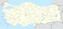
Location of airport in Turkey
Show map of Turkey
LTBL
LTBL (NATO)
Show map of NATO| Direction | Length | Surface | |
|---|---|---|---|
| m | ft | ||
| 17/35 | 2,994 | 9,821 | Asphalt |
Çiğli Air Base (Turkish: Çiğli Hava Üssü) (IATA: IGL, ICAO: LTBL) is a military airport near Çiğli,[1] a metropolitan district of the city of İzmir in İzmir Province, Turkey.
It served as İzmir's airport until the opening of the Adnan Menderes Airport, situated south of the metropolitan area.
Facilities
The airport resides at an elevation of 16 feet (5 m) above mean sea level. It has one runway designated 17/35 with an asphalt surface measuring 2,993 by 45 metres (9,820 ft × 148 ft).[1]
References
- ^ a b c Airport information for LTBL[usurped] from DAFIF (effective October 2006)
- ^ Airport information for IGL at Great Circle Mapper. Source: DAFIF (effective October 2006).
External links
- Current weather for LTBL at NOAA/NWS
- Accident history for IGL at Aviation Safety Network
- v
- t
- e
 | This geographical article about a location in İzmir Province, Turkey is a stub. You can help Wikipedia by expanding it. |
- v
- t
- e


