Liste der Flughäfen und Flugplätze in Paraguay
Die Liste der Flughäfen und Flugplätze in Paraguay zeigt die Flughäfen und Flugplätze des südamerikanischen Staates Paraguay, geordnet nach Orten.
Namen in Fettschrift zeigen regelmäßigen Linienverkehr an.
| Ort | Departamento | ICAO-Code | IATA-Code | Name des Flughafens | Koordinaten | Foto |
|---|---|---|---|---|---|---|
| Asunción / Luque | Departamento Central | SGAS | ASU | Silvio Pettirossi International Airport | 25° 14′ 23″ S, 57° 31′ 9″ W-25.239722222222-57.519166666667 | 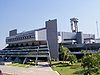 |
| Ayolas | Misiones | SGAY | AYO | Juan de Ayolas Airport | 27° 22′ 14″ S, 56° 51′ 14″ W-27.370555555556-56.853888888889 |  |
| Ciudad del Este / Minga Guazú | Alto Paraná | SGES | AGT | Aeropuerto Internacional Guaraní | 25° 27′ 20″ S, 54° 50′ 37″ W-25.455555555556-54.843611111111 |  |
| Concepción | Concepción | SGCO | CIO | Teniente Coronel Carmelo Peralta Airport | 23° 16′ 30″ S, 57° 25′ 40″ W-23.275-57.427777777778 | |
| Encarnación / Capitán Miranda | Itapúa | SGEN | ENO | Teniente Amin Ayub Gonzalez Airport | 27° 18′ 0″ S, 55° 54′ 44″ W-27.3-55.912222222222 |  |
| Filadelfia | Boquerón | SGFI | FLM | Filadelfia Airport | 22° 21′ 35″ S, 60° 3′ 13″ W-22.359722222222-60.053611111111 | |
| Fuerte Olimpo | Alto Paraguay | SGOL | Tte. 1ro Inocencio Herebia Airport | 21° 2′ 45″ S, 57° 53′ 0″ W-21.045833333333-57.883333333333 | ||
| Hernandarias | Alto Paraná | SGIB | Itaipu Airport | 25° 24′ 25″ S, 54° 37′ 10″ W-25.406944444444-54.619444444444 | ||
| La Victoria | Alto Paraguay | SGLV | La Victoria Airport | 22° 17′ 45″ S, 57° 52′ 0″ W-22.295833333333-57.866666666667 | ||
| Mariscal Estigarribia | Boquerón | SGME | ESG | Dr. Luis Maria Argaña International Airport | 22° 2′ 42″ S, 60° 37′ 18″ W-22.045-60.621666666667 | |
| Pedro Juan Caballero | Amambay | SGPJ | PJC | Dr. Augusto Roberto Fuster International Airport | 22° 38′ 29″ S, 55° 49′ 47″ W-22.641388888889-55.829722222222 | |
| Pilar | Ñeembucú | SGPI | PIL | Carlos Miguel Jiménez Airport | 26° 52′ 53″ S, 58° 19′ 4″ W-26.881388888889-58.317777777778 | |
| Puerto Vallemi | Concepción | SGVM | VMI | Dr. Juan Plate Airport | 22° 9′ 30″ S, 57° 56′ 35″ W-22.158333333333-57.943055555556 | |
| Salto del Guairá | Canindeyú | SGGR | Salto del Guairá Airport | 24° 2′ 0″ S, 54° 21′ 0″ W-24.033333333333-54.35 | ||
| Santa Teresa | Amambay | SGST | Santa Teresa Airport | 22° 37′ 25″ S, 56° 38′ 5″ W-22.623611111111-56.634722222222 |
Siehe auch
Weblinks
- IATA-Code-Suche
- Airport Code Database Search
- Great Circle Mapper. – IATA and ICAO codes
- Karte mit allen Koordinaten:
- OSM
- WikiMap


