Kanton Vertou
| Kanton Vertou | |
|---|---|
| Geografie | |
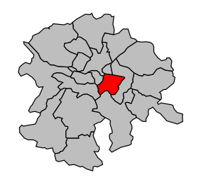 Kanton na mapě arrondissementu Nantes | |
| Hlavní město | Vertou |
| Souřadnice | 47°10′5″ s. š., 1°28′17″ z. d. |
| Rozloha | 48,7 km² |
| Obyvatelstvo | |
| Počet obyvatel | 29 955 (2012) |
| Hustota zalidnění | 615,1 obyv./km² |
| Správa regionu | |
| Stát | Francie Francie Francie |
| Region | Pays de la Loire |
| Departement | Loire-Atlantique |
| Arrondissement | Nantes |
| Druh celku | Kanton |
| Podřízené celky | Obce (počet: 2) |
| Vznik | 22. března 2015 |
| Některá data mohou pocházet z datové položky. | |
Kanton Vertou (fr. Canton de Vertou) je francouzský kanton v departementu Loire-Atlantique v regionu Pays de la Loire. Tvoří ho dvě obce.
Obce kantonu
- Les Sorinières
- Vertou
 | Tento článek je příliš stručný nebo postrádá důležité informace. Pomozte Wikipedii tím, že jej vhodně rozšíříte. Nevkládejte však bez oprávnění cizí texty. |
| Kantony v departementu Loire-Atlantique | ||
|---|---|---|
| Aigrefeuille-sur-Maine • Ancenis • La Baule-Escoublac • Blain • Bouaye • Bourgneuf-en-Retz • Carquefou • La Chapelle-sur-Erdre • Châteaubriant • Clisson • Le Croisic • Derval • Guémené-Penfao • Guérande • Herbignac • Legé • Ligné • Le Loroux-Bottereau • Machecoul • Moisdon-la-Rivière • Montoir-de-Bretagne • Nantes-1 • Nantes-2 • Nantes-3 • Nantes-4 • Nantes-5 • Nantes-6 • Nantes-7 • Nantes-8 • Nantes-9 • Nantes-10 • Nantes-11 • Nort-sur-Erdre • Nozay • Orvault • Paimbœuf • Le Pellerin • Pontchâteau • Pornic • Rezé • Riaillé • Rougé • Saint-Étienne-de-Montluc • Saint-Gildas-des-Bois • Saint-Herblain-Est • Saint-Herblain-Ouest-Indre • Saint-Julien-de-Vouvantes • Saint-Mars-la-Jaille • Saint-Nazaire-Centre • Saint-Nazaire-Est • Saint-Nazaire-Ouest • Saint-Nicolas-de-Redon • Saint-Père-en-Retz • Saint-Philbert-de-Grand-Lieu • Savenay • Vallet • Varades • Vertou • Vertou-Vignoble |  | |
Portály: Francie


